Map of Massachusetts and Rhode Island
Item Information
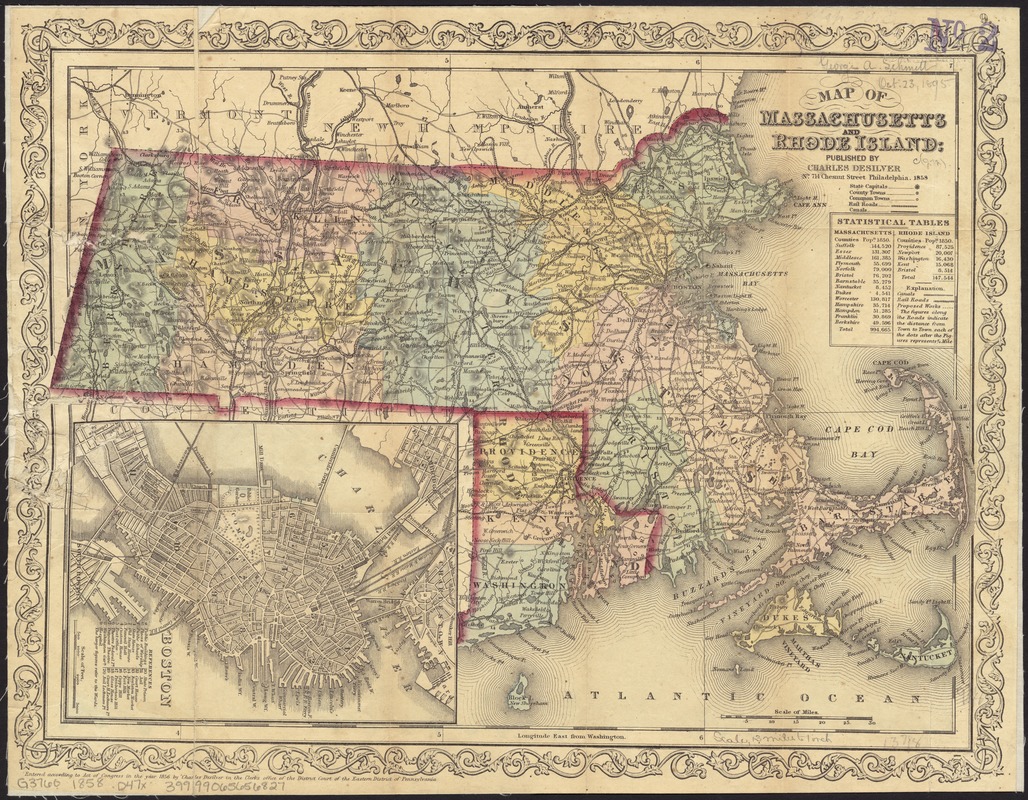
- Title:
- Map of Massachusetts and Rhode Island
- Creator:
- Desilver, Charles.
- Date:
-
1858
- Format:
-
Maps/Atlases
- Location:
-
Boston Public Library
Norman B. Leventhal Map Center - Collection (local):
-
Norman B. Leventhal Map Center Collection
- Subjects:
-
Counties--Massachusetts--Maps
Counties--Rhode Island--Maps
Massachusetts--Maps
Rhode Island--Maps
- Places:
-
Massachusetts
Rhode Island
- Extent:
- 1 map : hand col. ; 26 x 35 cm.
- Terms of Use:
-
No known copyright restrictions.
No known restrictions on use.
- Publisher:
-
Philadelphia :
Charles Desilver
- Scale:
-
Scale [ca. 1:810,000]
- Language:
-
English
- Notes:
-
Relief shown by hachures.
"Entered according to Act of Congress in the year 1856 by Charles Desilver ..."
Prime meridian: Washington, D.C.
Inset: Boston. Scale [ca. 1:27,400]. Includes "references" to points of interest.
Includes table of populations in Massachusetts and Rhode Island.
- Identifier:
-
06_01_008701
- Call #:
-
G3760 1858 .D47x
- Barcode:
-
39999065656827


