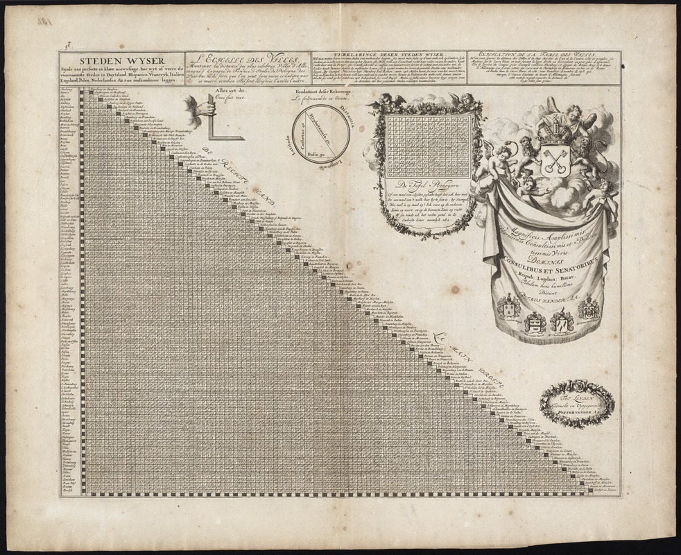
Steden Wyser synde een perfecte en klare aenwysinge ... Leggen = L'echelle des villes montrant la distance ... l'autre
Item Information
- Title:
- Steden Wyser synde een perfecte en klare aenwysinge ... Leggen = L'echelle des villes montrant la distance ... l'autre
- Title (alt.):
-
Collection of old maps
- Creator:
- Aa, Pieter van der, 1659-1733
- Date:
-
[1729]
- Format:
-
Maps/Atlases
- Location:
-
Boston Public Library
Norman B. Leventhal Map Center - Collection (local):
-
Norman B. Leventhal Map Center Collection
- Extent:
- 1 sheet ; 43 x 54 cm.
- Terms of Use:
-
No known copyright restrictions.
No known restrictions on use.
- Publisher:
-
Tot Leyden :
Gedruckt en uytgegeven by Pieter van der Aa
- Scale:
-
Not drawn to scale.
- Language:
-
Dutch
- Notes:
-
Distance chart of cities in Europe and Palestine.
Includes dedication in elaborate cartouche and ill.
Text in Dutch and French.
Cataloging, conservation, and digitization made possible in part by The National Endowment for the Humanities: Exploring the human endeavor.
Part of composite portfolio atlas with title "Collection of old maps."
- Notes (date):
-
This date is inferred.
- Identifier:
-
06_01_009452
- Call #:
-
G1015 .C65 1630
- Barcode:
-
30000003860392


