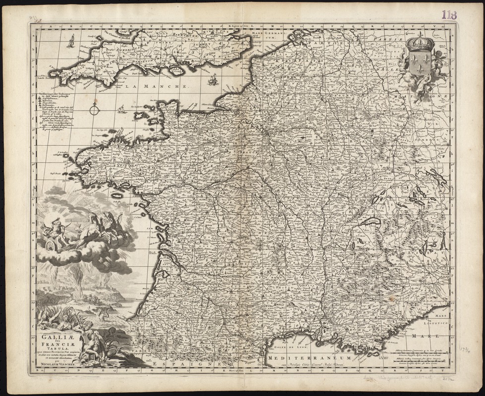
Galliae seu Franciae tabula, qua omnes provinciae, via angiariae, et aliae res notatu dignae distincte et accurate ostendatur
Item Information
- Title:
- Galliae seu Franciae tabula, qua omnes provinciae, via angiariae, et aliae res notatu dignae distincte et accurate ostendatur
- Title (alt.):
-
Collection of old maps
- Creator:
- Visscher, Nicolaes, 1649-1702
- Name on Item:
-
per Nicolaum Visscher.
- Date:
-
[ca. 1690]
- Format:
-
Maps/Atlases
- Location:
-
Boston Public Library
Norman B. Leventhal Map Center - Collection (local):
-
Norman B. Leventhal Map Center Collection
- Subjects:
-
France--Maps--Early works to 1800
Gaul--Maps--Early works to 1800
- Places:
-
France
- Extent:
- 1 map ; 45 x 56 cm.
- Terms of Use:
-
No known copyright restrictions.
No known restrictions on use.
- Publisher:
-
Amsterdam :
Nicolaes Visscher
- Scale:
-
Scale [ca. 1:2,500,000]
- Language:
-
Latin
- Notes:
-
Map of France.
Relief shown pictorially.
Includes reference grid.
Includes elaborate illustration depicting a scene from Ovid's Metamorphoses, book 2, verse 191.
"Cum Privilegio Ordin: General: Belgii Federati."
Accompanied by a list of place names with pasted-on title "An alphabetical table of all the cities, towns, villages and all other places of merit in the Kingdom of France, & circumjacent lands, & how they are to bee found in this mapp."
May have appeared in Nicolaes Visscher's Atlas Minor. Amstelaedami : Ex Officina Nicolai Visscer, [ca. 1690].
Cataloging, conservation, and digitization made possible in part by The National Endowment for the Humanities: Exploring the human endeavor.
Part of composite portfolio atlas with title "Collection of old maps."
- Identifier:
-
06_01_009410
- Call #:
-
G1015 .C65 1630
- Barcode:
-
30000003859752


![[Frantia]](https://bpldcassets.blob.core.windows.net/derivatives/images/commonwealth:7h14b063x/image_thumbnail_300.jpg)
