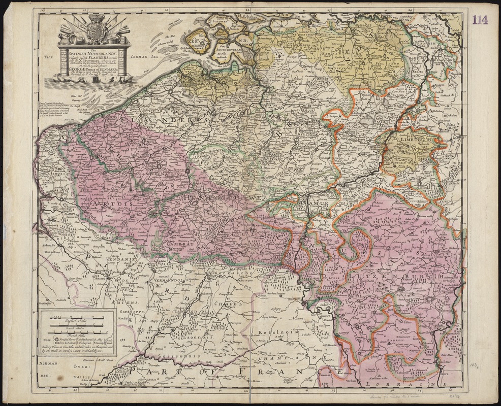
The Spainish Netherlands, vulgarly called Flanders, devided into its X provinces, wherein are delineated the fortified towns roads &c
Item Information
- Title:
- The Spainish Netherlands, vulgarly called Flanders, devided into its X provinces, wherein are delineated the fortified towns roads &c
- Title (alt.):
-
Spanish Netherlands, vulgarly called Flanders, divided into its ten provinces
Collection of old maps
- Creator:
- Moll, Herman, d. 1732
- Name on Item:
-
Herman Moll fecit.
- Date:
-
[1690]
- Format:
-
Maps/Atlases
- Location:
-
Boston Public Library
Norman B. Leventhal Map Center - Collection (local):
-
Norman B. Leventhal Map Center Collection
- Subjects:
-
Flanders--Maps--Early works to 1800
- Places:
-
Flanders
- Extent:
- 1 map : hand col. ; 49 x 56 cm.
- Terms of Use:
-
No known copyright restrictions.
No known restrictions on use.
- Publisher:
-
[London] :
Sold by P. Lea at the Atlas and Hercules in Cheapside and by H. Moll in Vanly's Court in Blackfryers
- Scale:
-
Scale [ca. 1:650,000]
- Language:
-
English
- Notes:
-
Map of Flanders, in France and Belgium.
Relief shown pictorially.
"To His Royal Highness George Prince of Denmark &c. This Mapp is most Humbly Dedicated and Presented by P. Lea and H. Moll."
Cataloging, conservation, and digitization made possible in part by The National Endowment for the Humanities: Exploring the human endeavor.
Part of composite portfolio atlas with title "Collection of old maps."
- Notes (date):
-
This date is inferred.
- Identifier:
-
06_01_009388
- Call #:
-
G1015 .C65 1630
- Barcode:
-
30000003859205