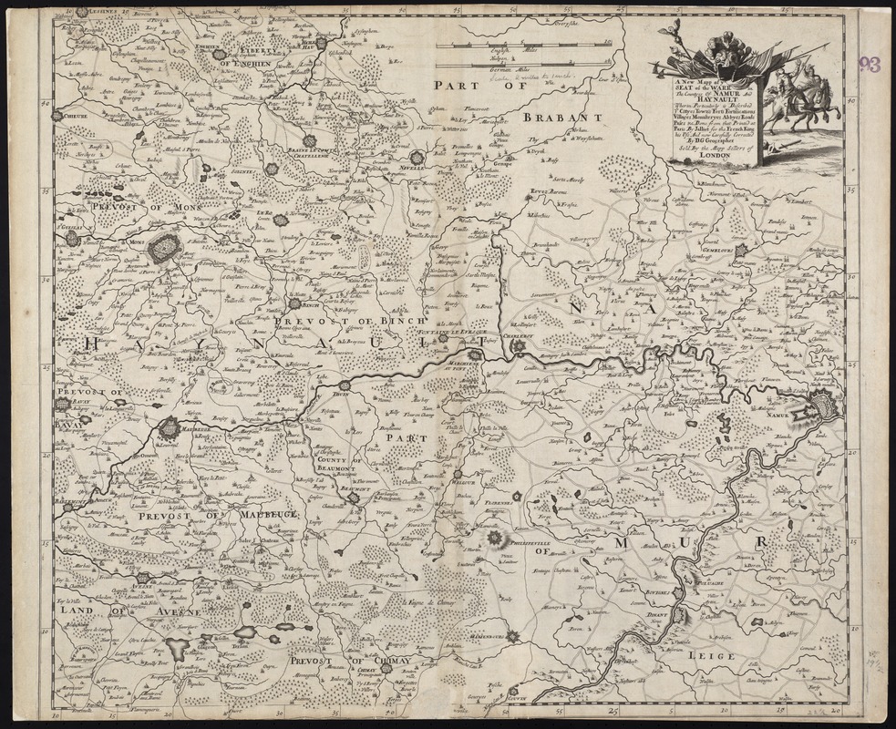
A new mapp of ye seat of the warr in the counties of Namur and Hainault wherin perticulerly is described ye cittyes town's fort's fortifications villages monasteryes abbyes roads pases &c
Item Information
- Title:
- A new mapp of ye seat of the warr in the counties of Namur and Hainault wherin perticulerly is described ye cittyes town's fort's fortifications villages monasteryes abbyes roads pases &c
- Title (alt.):
-
Collection of old maps
- Name on Item:
-
done from that printed at Paris by Jalliot for the French King his use and now carefully corrected by D.G., Geographer.
- Date:
-
[1692?]
- Format:
-
Maps/Atlases
- Location:
-
Boston Public Library
Norman B. Leventhal Map Center - Collection (local):
-
Norman B. Leventhal Map Center Collection
- Subjects:
-
Grand Alliance, War of the, 1689-1697--Maps--Early works to 1800
Namur (Belgium)--Maps--Early works to 1800
Hainaut (Belgium)--Maps--Early works to 1800
- Places:
-
BelgiumHainaut, Province de (province)
- Extent:
- 1 map ; 53 x 58 cm.
- Terms of Use:
-
No known copyright restrictions.
No known restrictions on use.
- Publisher:
-
London :
[s.n.]
- Scale:
-
Scale [ca. 1:130,000]
- Language:
-
English
- Notes:
-
Relief shown pictorially.
Date taken from date of William III's campaign.
"Sold by the mapp sellers of London".
Cataloging, conservation, and digitization made possible in part by The National Endowment for the Humanities: Exploring the human endeavor.
Part of composite portfolio atlas with title "Collection of old maps."
- Identifier:
-
06_01_009284
- Call #:
-
G1015 .C65 1630
- Barcode:
-
30000003858172