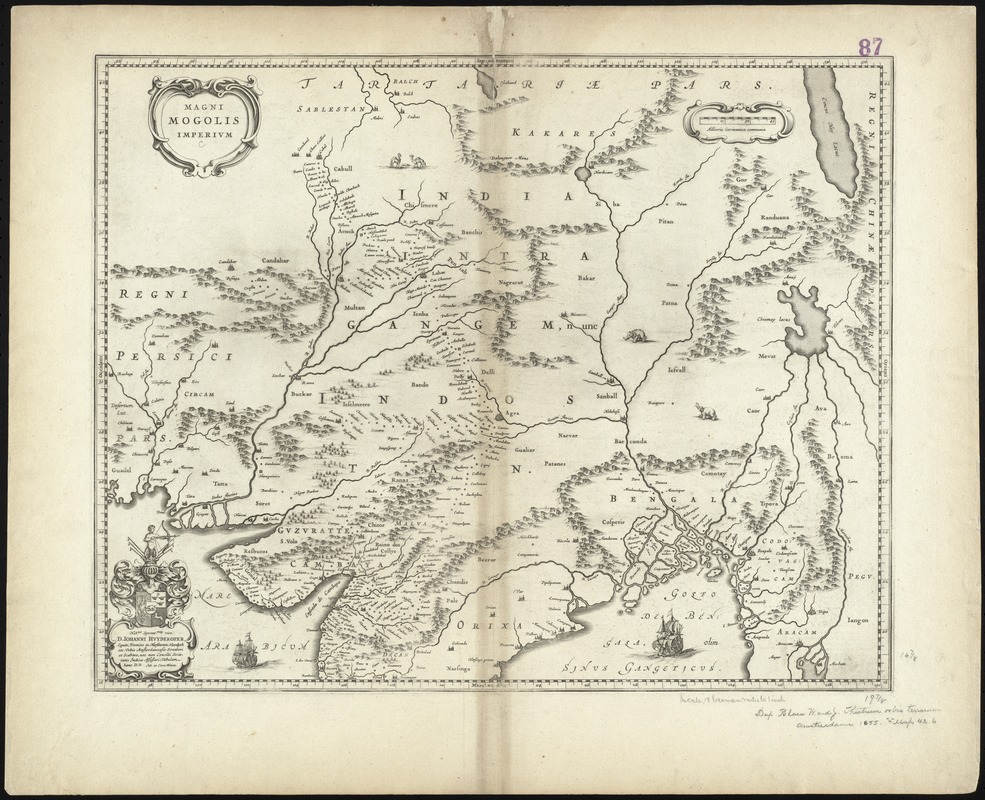
Magni Mogolis Imperium
Item Information
- Title:
- Magni Mogolis Imperium
- Title (alt.):
-
Magni Mogolis Imperivm
Collection of old maps
- Creator:
- Blaeu, Joan, 1596-1673
- Date:
-
1640
- Format:
-
Maps/Atlases
- Location:
-
Boston Public Library
Norman B. Leventhal Map Center - Collection (local):
-
Norman B. Leventhal Map Center Collection
- Subjects:
-
India--Maps--Early works to 1800
Mogul Empire--Maps--Early works to 1800
South Asia--Maps--Early works to 1800
- Places:
-
Southern Asia (area)
IndiaMughal Empire (former primary political entity)
- Extent:
- 1 map : col. ; 41 x 51 cm.
- Terms of Use:
-
No known copyright restrictions.
No known restrictions on use.
- Publisher:
-
Amsterdam :
Joh. et Corn. Blaeu
- Scale:
-
Scale [ca. 1:7,000,000]
- Language:
-
Latin
- Notes:
-
Relief shown pictorially.
Shows "Indostan" [central and upper India] and Bengal, and adjacent areas of Persia, the Tartan empire, and China.
Includes illustrations of ships and elephants.
Includes dedication to D. Iohanni Huydekoper by Joh. et Corn. Blaeu.
Verso is blank.
Cataloging, conservation, and digitization made possible in part by The National Endowment for the Humanities: Exploring the human endeavor.
Part of composite portfolio atlas with title "Collection of old maps."
- Identifier:
-
06_01_009260
- Call #:
-
G1015 .C65 1630
- Barcode:
-
30000003857290