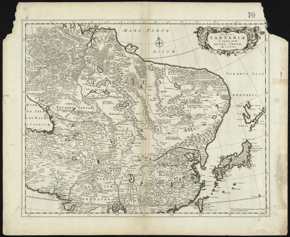
Tabula Tartariae et majoris partis Regni Chinae
Item Information
- Title:
- Tabula Tartariae et majoris partis Regni Chinae
- Title (alt.):
-
Collection of old maps
- Creator:
- Wit, Frederik de.
- Name on Item:
-
edita a F. de Wit.
- Date:
-
[1680]
- Format:
-
Maps/Atlases
- Location:
-
Boston Public Library
Norman B. Leventhal Map Center - Collection (local):
-
Norman B. Leventhal Map Center Collection
- Subjects:
-
East Asia--Maps--Early works to 1800
China--Maps--Early works to 1800
Siberia (Russia)--Maps--Early works to 1800
- Places:
-
East Asia (area)
China
Siberia (area)
- Extent:
- 1 map ; 42 x 54 cm.
- Terms of Use:
-
No known copyright restrictions.
No known restrictions on use.
- Publisher:
-
Amsterdam :
F. de Wit
- Scale:
-
Scale [ca. 1:15,000,000]
- Language:
-
Latin
- Notes:
-
Gedruckt t'Amsterdam by Frederick de Wit voor aen inde Calverstraet by den Dam inde Witte Pascaart.
Relief shown pictorially.
Cataloging, conservation, and digitization made possible in part by The National Endowment for the Humanities: Exploring the human endeavor.
Part of composite portfolio atlas with title "Collection of old maps."
- Notes (date):
-
This date is inferred.
- Identifier:
-
06_01_009244
- Call #:
-
G1015 .C65 1630
- Barcode:
-
30000003854367