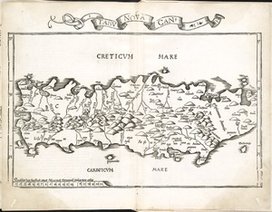
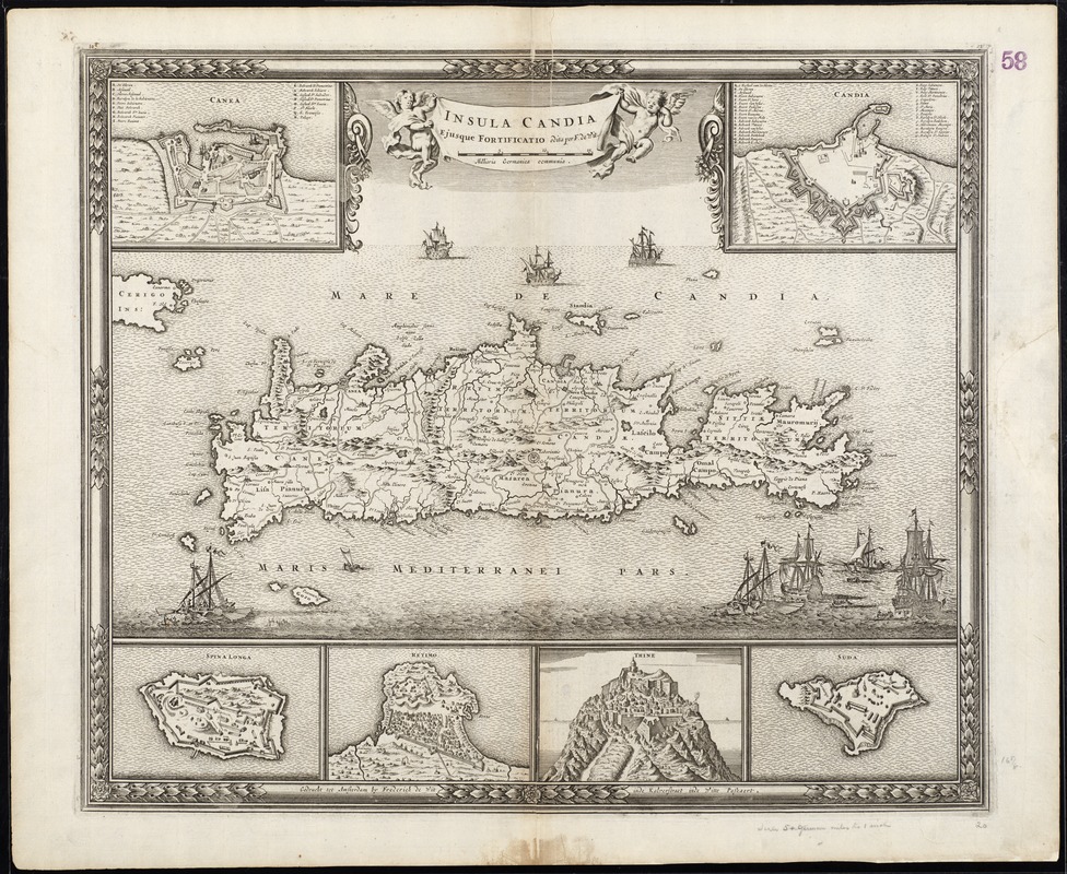
Insula Candia : ejusque fortificatio
Item Information
- Title:
- Insula Candia : ejusque fortificatio
- Title (alt.):
-
Collection of rare maps
- Creator:
- Wit, Frederik de.
- Name on Item:
-
edita per F. de Wit.
- Date:
-
[1680]
- Format:
-
Maps/Atlases
- Location:
-
Boston Public Library
Norman B. Leventhal Map Center - Collection (local):
-
Norman B. Leventhal Map Center Collection
- Subjects:
-
Crete (Greece)--Maps--Early works to 1800
- Places:
-
Crete (region)
- Extent:
- 1 map ; 34 x 51 cm, on sheet 52 x 63 cm.
- Terms of Use:
-
No known copyright restrictions.
No known restrictions on use.
- Publisher:
-
[Amsterdam] :
Frederick de Wit inde Kalverstraet inde Witte Paskaert
- Scale:
-
Scale [ca. 1:470,000]
- Language:
-
Latin
- Notes:
-
Relief shown pictorially.
Includes insets: Canea -- Spina Longa -- Retimo -- Thine -- Suda -- Candia.
From: Atlas sive descriptio terrarum orbis ... / Frederik de Wit. Amsterdam : Frederik de Wit, [ca. 1680].
Date of publication from Zacharakis.
Cataloging, conservation, and digitization made possible in part by The National Endowment for the Humanities: Exploring the human endeavor.
Part of composite portfolio atlas with title "Collection of old maps."
- Notes (date):
-
This date is inferred.
- Identifier:
-
06_01_009088
- Call #:
-
G1015 .C65 1630
- Barcode:
-
30000003849990