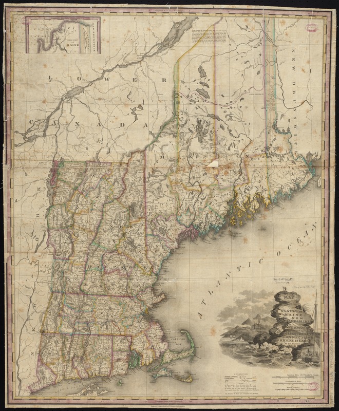
Map of the states of Maine, New Hampshire, Vermont, Massachusetts, Connecticut & Rhode Island
Item Information
- Title:
- Map of the states of Maine, New Hampshire, Vermont, Massachusetts, Connecticut & Rhode Island
- Creator:
- Tanner, Henry Schenck, 1786-1858
- Name on Item:
-
by H.S. Tanner.
- Date:
-
1831
- Format:
-
Maps/Atlases
- Location:
-
Boston Public Library
Norman B. Leventhal Map Center - Collection (local):
-
Norman B. Leventhal Map Center Collection
- Subjects:
-
New England--Maps
- Places:
-
New England (area)
- Extent:
- 1 map : hand col. ; 64 x 51 cm.
- Terms of Use:
-
No known copyright restrictions.
No known restrictions on use.
- Publisher:
-
Philadelphia :
H.S. Tanner
- Scale:
-
Scale [ca. 1:1,150,000]
- Language:
-
English
- Notes:
-
Relief shown by hachures.
Prime meridians: Washington and Greenwich.
Inset: North part of Maine.
- Identifier:
-
06_01_008659
- Call #:
-
G3720 1831 .T36x
- Barcode:
-
39999065655894


