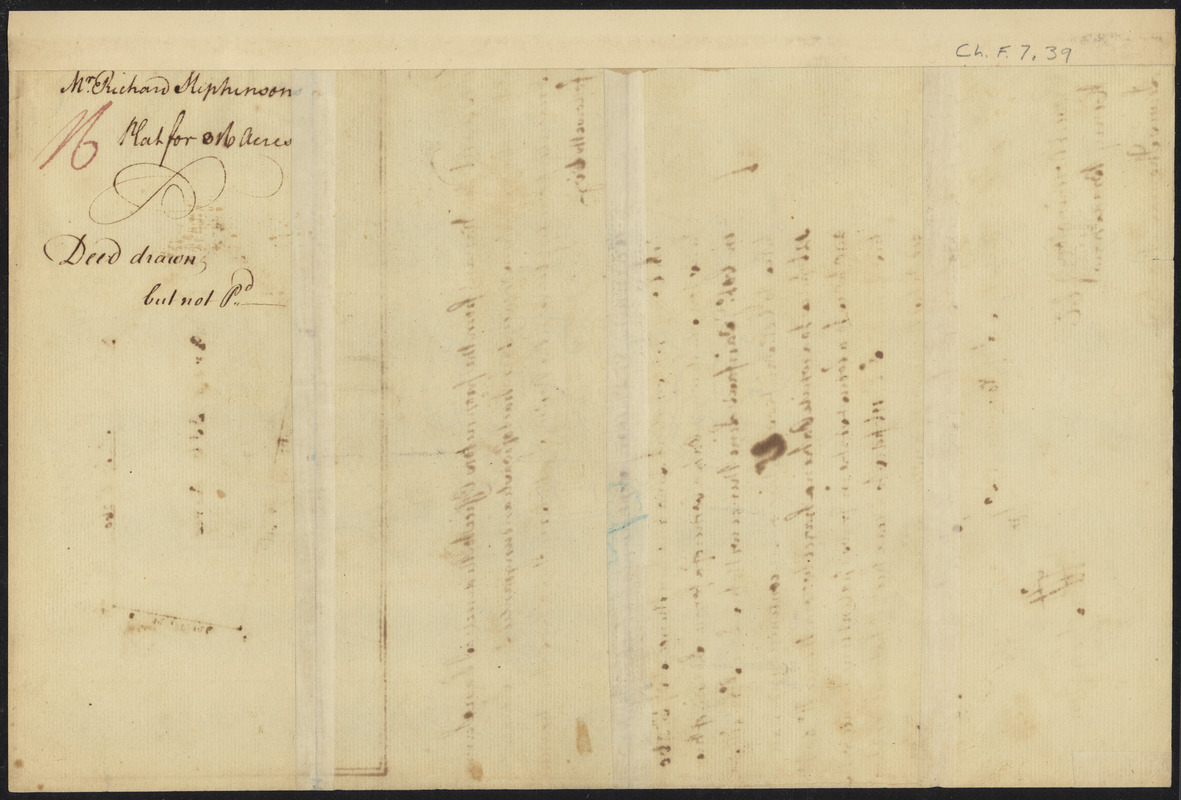
Survey of land for Richard Stephenson in Frederick County; attested by Robert Worthington, Henry Bradshaw and Lewis Thomas : verso
This map is also available in American Revolutionary Geographies Online (ARGO), a collections portal especially built for material relating to the American Revolutionary War Era. Visit ARGO to learn more about this item and explore the historical geography of North America in the late eighteenth century.
Item Information
- Title:
- Survey of land for Richard Stephenson in Frederick County; attested by Robert Worthington, Henry Bradshaw and Lewis Thomas : verso
- Description:
-
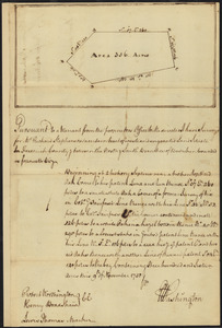
Maps of individual colonies were compiled using the most accurate and recent information. They consulted published maps in combination with data from surveys of local geographical features, such as roads, rivers, or landholdings. This property survey by George Washington at age 18 is one example of these maps. This map is one of approximately 75 surviving surveys of the 199 that Washington completed during his career as a county surveyor. This survey documents 316 acres between the north and south branches of Bullskin Run, which is located in present-day Jefferson County, West Virginia.
- Cartographer:
- Washington, George, 1732-1799
- Date:
-
1750
- Format:
-
Maps/Atlases
Manuscripts
- Location:
-
Boston Public Library
Rare Books Department - Collection (local):
-
Special Collections, Rare Books
- Subjects:
-
Frederick County (Va.)--Maps
Real property--Virginia--Frederick County--Maps
Manuscript maps
- Places:
-
Frederick (county)
- Extent:
- 1 map ; on sheet 26 x 20 cm
- Terms of Use:
-
No known copyright restrictions.
No known restrictions on use.
- Language:
-
English
- Notes:
-
Manuscript survey plat.
- Identifier:
-
06_01_009178
- Call #:
-
BPL Rare Books Dept. Ch.F.7.39


![Armstrong C[ount]y](https://bpldcassets.blob.core.windows.net/derivatives/images/commonwealth:q524ng353/image_thumbnail_300.jpg)
