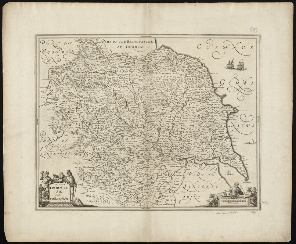
Ducatus Eboracensis, anglice Yorkshire
Item Information
- Title:
- Ducatus Eboracensis, anglice Yorkshire
- Title (alt.):
-
Yorkshire
- Creator:
- Jansson, Jan, 1588-1664
- Date:
-
[1646?]
- Format:
-
Maps/Atlases
- Location:
-
Boston Public Library
Norman B. Leventhal Map Center - Collection (local):
-
Norman B. Leventhal Map Center Collection
- Subjects:
-
Yorkshire (England)--Maps--Early works to 1800
- Places:
-
EnglandYorkshire (area)
- Extent:
- 1 map ; 37 x 49 cm.
- Terms of Use:
-
No known copyright restrictions.
No known restrictions on use.
- Publisher:
-
Amstelodami :
apud Ioannem Iansonium
- Scale:
-
Scale [ca. 1:356,000] ;
- Language:
-
English
Latin
French
- Notes:
-
Relief shown pictorially.
Shows wapentake boundaries, rivers, woods, parks and settlements.
Cartouche decorated with a workmen and surveyor figures.
Lacks text on verso. Struck from the same plate as a map found in: Le nouvel atlas ou Theatre du Monde : auquel est representée la Grande Bretagne... Amstelodami : apud Joannem Janssonium, 1646. (V. 4, p. 291-292 , plate no. 39).
Title in Latin and English, place names in English.
Cataloging, conservation, and digitization made possible in part by The National Endowment for the Humanities: Exploring the human endeavor.
Part of composite portfolio atlas with title "Collection of old maps."
- Identifier:
-
06_01_010008
- Call #:
-
G1015 .C651 1630
- Barcode:
-
30000003115224


