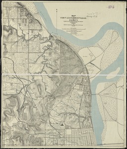
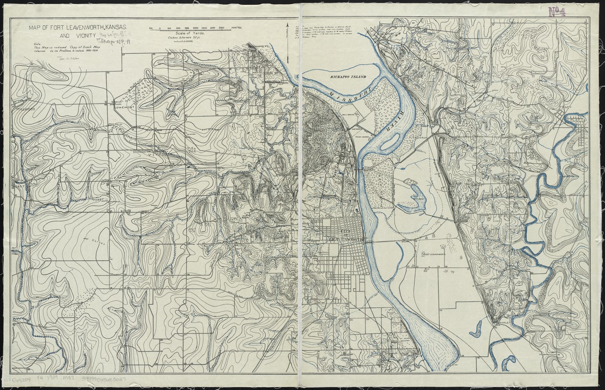
Map of Fort Leavenworth, Kansas and vicinity
Item Information
- Title:
- Map of Fort Leavenworth, Kansas and vicinity
- Date:
-
[1909?]
- Format:
-
Maps/Atlases
- Location:
-
Boston Public Library
Norman B. Leventhal Map Center - Collection (local):
-
Norman B. Leventhal Map Center Collection
- Subjects:
-
Fort Leavenworth (Kan.)--Maps
- Places:
-
Leavenworth (county)Fort Leavenworth (defense installation)
- Extent:
- 1 map : col. ; 52 x 85 cm.
- Terms of Use:
-
No known copyright restrictions.
No known restrictions on use.
- Publisher:
-
Fort Leavenworth, Kan :
General Service Schools
- Scale:
-
Scale 1:31,680. 2 in.=1 mi.
- Language:
-
English
- Notes:
-
Relief shown by contours.
"Note: This map is reduced copy of 3 inch map referred to in problems to include 1908-1909."
- Identifier:
-
06_01_008593
- Call #:
-
G4204.F4 1909 .M37
- Barcode:
-
39999065655027