Geological map of the United States
Item Information
- Title:
- Geological map of the United States
- Description:
-
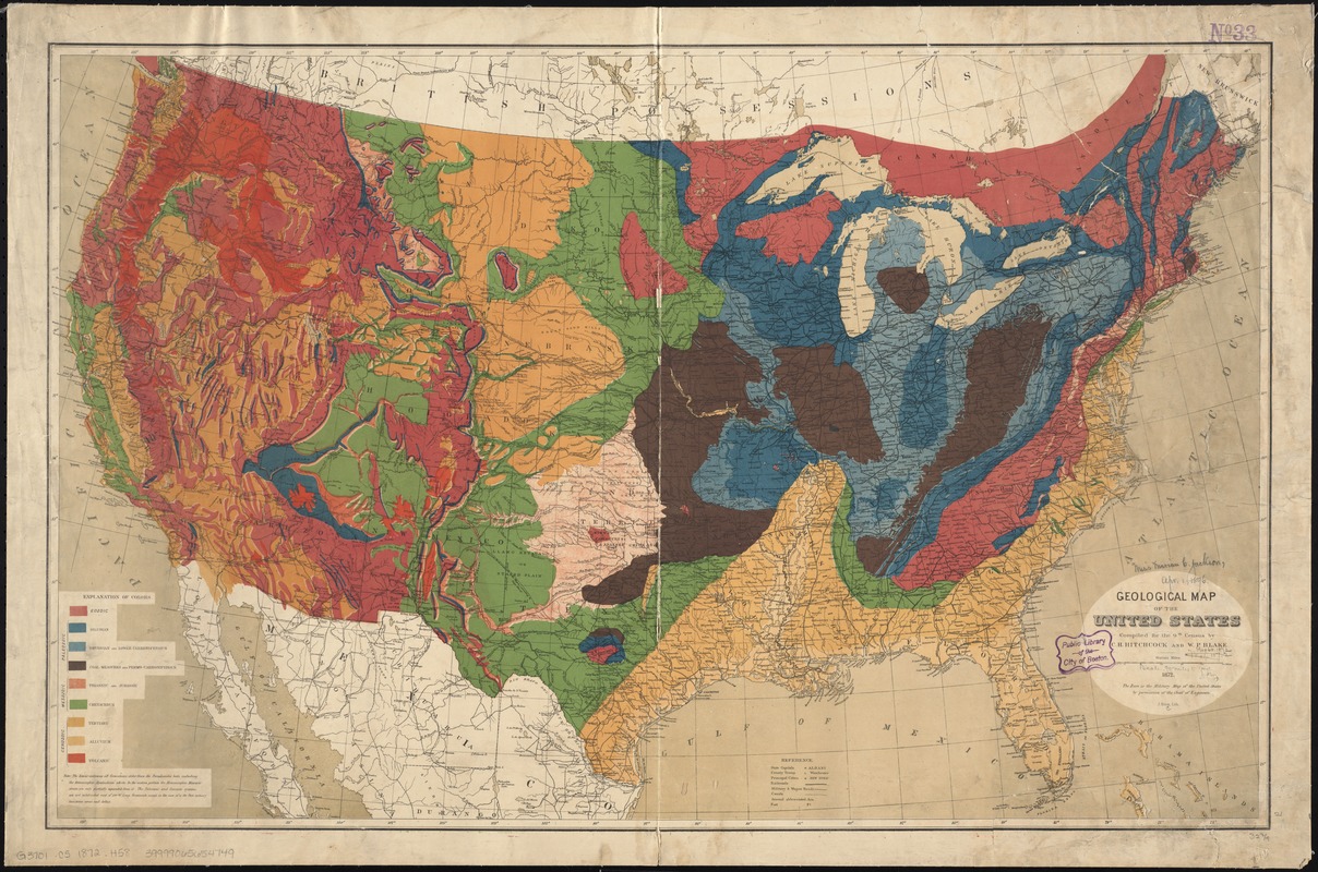
The Hitchcock family’s interest in geology passed from Edward to his son Charles, who by 1861 was appointed the State Geologist in Maine, and later in the decade State Geologist in New Hampshire. Geologic mapping of the area west of the Mississippi River grew rapidly after the Civil War, and the 1872 map displayed here by Hitchcock and William Blake is an example of that effort. Prepared for the 1870 statistical atlas of the United States, this map represents a transition from earlier 19th-century examples, as it uses highly detailed placement of vivid colors to differentiate between geologic time periods, and examines the fossils contained within the rocks.
- Creator:
- Hitchcock, Charles H. (Charles Henry), 1836-1919
- Name on Item:
-
compiled for the 9th census by C.H. Hitchcock and W.P. Blake.
- Date:
-
1872
- Format:
-
Maps/Atlases
- Location:
-
Boston Public Library
Norman B. Leventhal Map Center - Collection (local):
-
Norman B. Leventhal Map Center Collection
- Subjects:
-
Geology--United States--Maps
United States--Census, 1870
- Places:
-
- Extent:
- 1 map : col. ; 53 x 84 cm.
- Terms of Use:
-
No known copyright restrictions.
No known restrictions on use.
- Publisher:
-
Washington, D.C :
[G.P.O.]
- Scale:
-
Scale [ca. 1:5,700,000]
- Language:
-
English
- Notes:
-
Issued with vol. 3 of the 9th census report.
- Notes (exhibitions):
-
Exhibited: "Beneath Our Feet: Mapping the World Below" organized by the Norman B. Leventhal Map Center at the Boston Public Library, 2017-2018.
- Identifier:
-
06_01_008455
- Call #:
-
G3701.C5 1872 .H58
- Barcode:
-
39999065654749


