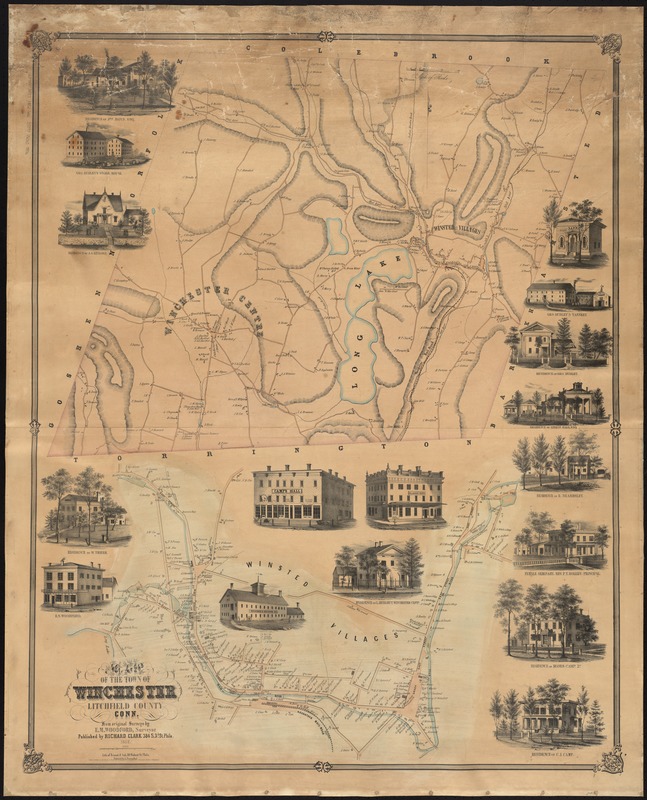
Map of the town of Winchester, Litchfield County, Conn
Item Information
- Title:
- Map of the town of Winchester, Litchfield County, Conn
- Creator:
- Woodford, E. M.
- Name on Item:
-
from original surveys by E.M. Woodford ; lith. of Friend & Aub.
- Date:
-
1852
- Format:
-
Maps/Atlases
- Location:
-
Boston Public Library
Norman B. Leventhal Map Center - Collection (local):
-
Norman B. Leventhal Map Center Collection
- Subjects:
-
Real property--Connecticut--Winchester (Town)--Maps
Real property--Connecticut--Winsted--Maps
Winchester (Conn. : Town)--Maps
Winsted (Conn.)--Maps
- Places:
-
Litchfield (county)Winsted
Town of Winchester
- Extent:
- 1 map : col. ; 106 x 85 cm.
- Terms of Use:
-
No known copyright restrictions.
No known restrictions on use.
- Publisher:
-
Philadelphia :
Richard Clark
- Scale:
-
Scale [ca. 1:3,960]
- Language:
-
English
- Notes:
-
Relief shown by hachures.
Shows buildings and householders.
Includes views of local buildings.
Includes ancillary map: Winsted villages.
- Identifier:
-
06_01_008422
- Call #:
-
G3784.W77 1852 .W66
- Barcode:
-
39999065653956


