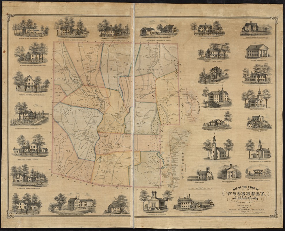
Map of the town of Woodbury, Litchfield County, Connecticut
Item Information
- Title:
- Map of the town of Woodbury, Litchfield County, Connecticut
- Creator:
- Fagan, L.
- Name on Item:
-
from actual surveys by L. Fagan ; Friend & Aub. lith.
- Date:
-
1853
- Format:
-
Maps/Atlases
- Location:
-
Boston Public Library
Norman B. Leventhal Map Center - Collection (local):
-
Norman B. Leventhal Map Center Collection
- Subjects:
-
Real property--Connecticut--Woodbury--Maps
Woodbury (Conn. : Town)--Maps
- Places:
-
Litchfield (county)Woodbury
- Extent:
- 1 map : col. ; 93 x 124 cm.
- Terms of Use:
-
No known copyright restrictions.
No known restrictions on use.
- Publisher:
-
Philadelphia [Pa.] :
Richard Clark
- Scale:
-
Scale [1:15,840]. 80 perches to an inch
- Language:
-
English
- Notes:
-
Relief shown by hachures.
Shows districts.
Shows buildings and householders.
Includes views of local buildings.
Insets: Woodbury -- Hotchkissville.
- Identifier:
-
06_01_008420
- Call #:
-
G3784.W884 1853 .F34
- Barcode:
-
39999065653923


