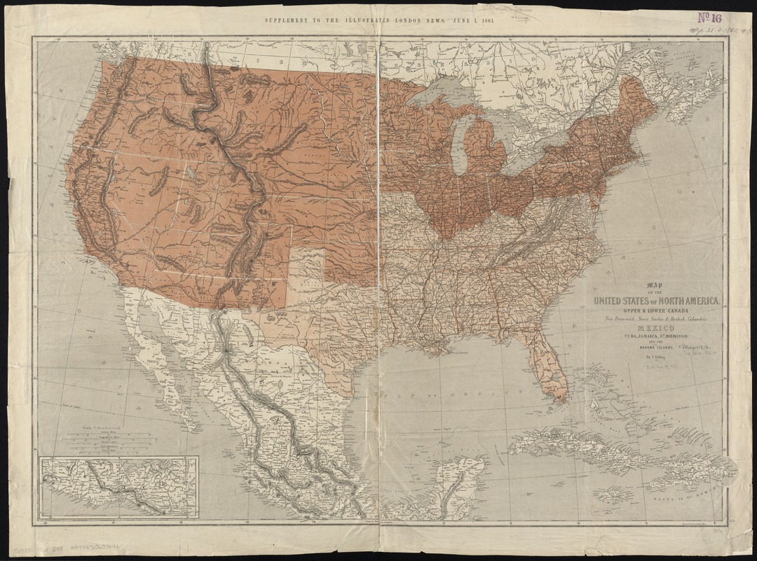
Map of the United States of North America, upper & lower Canada, New Brunswick, Nova Scotia & British Columbia, Mexico, Cuba, Jamaica, St. Domingo and the Bahama Islands
Item Information
- Title:
- Map of the United States of North America, upper & lower Canada, New Brunswick, Nova Scotia & British Columbia, Mexico, Cuba, Jamaica, St. Domingo and the Bahama Islands
- Creator:
- Ettling, Theodor, b. 1823
- Name on Item:
-
by T. Ettling.
- Date:
-
1861
- Format:
-
Maps/Atlases
- Location:
-
Boston Public Library
Norman B. Leventhal Map Center - Collection (local):
-
Norman B. Leventhal Map Center Collection
- Subjects:
-
United States--Maps
Mexico--Maps
West Indies--Maps
- Places:
-
Mexico
West Indies
- Extent:
- 1 map : col. ; 64 x 93 cm.
- Terms of Use:
-
No known copyright restrictions.
No known restrictions on use.
- Publisher:
-
Paris :
Paniconographie de Gillot
- Scale:
-
Scale 1:5,800,000
- Language:
-
English
- Notes:
-
General map showing state and international boundaries, railroads, cities, rivers, and relief by hachures. Two colors are used to differentiate between Union and Confederate states.
At top of map: Supplement to the Illustrated London News, June 1, 1861.
Inset: [Southern Mexico].
- Identifier:
-
06_01_008415
- Call #:
-
G3700 1861 .E88
- Barcode:
-
39999065653642
- LCCN:
-
99447021


