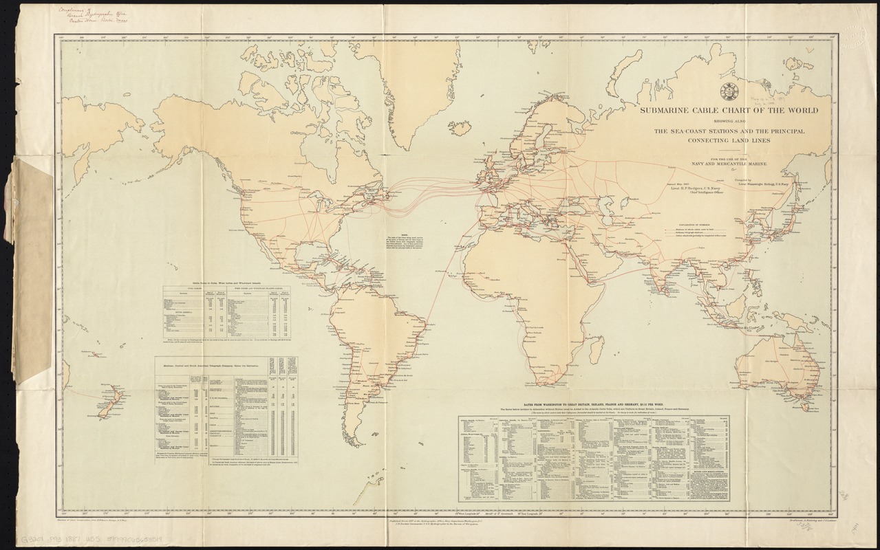
Submarine cable chart of the world : showing also the seacoast stations and the principal connecting land lines ; for the use of the navy and mercantile marine
Item Information
- Title:
- Submarine cable chart of the world : showing also the seacoast stations and the principal connecting land lines ; for the use of the navy and mercantile marine
- Creator:
- United States. Hydrographic Office. . Division of Chart Construstion
- Name on Item:
-
draftsmen A. Klakring and J. S. Latimer.
- Date:
-
1887
- Format:
-
Maps/Atlases
- Location:
-
Boston Public Library
Norman B. Leventhal Map Center - Collection (local):
-
Norman B. Leventhal Map Center Collection
- Subjects:
-
Cables, Submarine--Maps
Telegraph lines--Maps
World maps
- Places:
-
World
- Extent:
- 1 map : col. ; 53 x 86 cm.
- Terms of Use:
-
No known copyright restrictions.
No known restrictions on use.
- Publisher:
-
Washington, D.C :
Division of Chart Construction
- Scale:
-
Scale [ca. 1:48,000,000]
- Language:
-
English
- Notes:
-
Includes 3 tables of cable rates.
- Identifier:
-
06_01_008389
- Call #:
-
G3201.P93 1887 .U55
- Barcode:
-
39999065653519