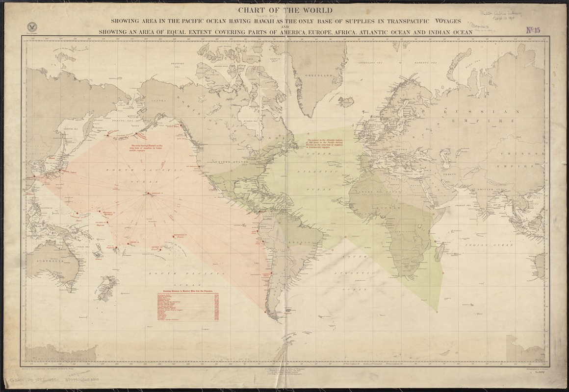
Chart of the world showing area in the Pacific Ocean having Hawaii as the only base of supplies in transpacific voyages and showing an area of equal extent covering parts of America, Europe, Africa, Atlantic Ocean and Indian Ocean
Item Information
- Title:
- Chart of the world showing area in the Pacific Ocean having Hawaii as the only base of supplies in transpacific voyages and showing an area of equal extent covering parts of America, Europe, Africa, Atlantic Ocean and Indian Ocean
- Creator:
- United States. Hydrographic Office
- Date:
-
1897
- Format:
-
Maps/Atlases
- Location:
-
Boston Public Library
Norman B. Leventhal Map Center - Collection (local):
-
Norman B. Leventhal Map Center Collection
- Subjects:
-
Armed Forces--Supplies and stores
World maps
- Places:
-
World
- Extent:
- 1 map : col. ; 67 x 109 cm.
- Terms of Use:
-
No known copyright restrictions.
No known restrictions on use.
- Publisher:
-
Washington, D.C :
Hydrographic Office
- Scale:
-
Scale [ca. 1:37,000,000] at equator
- Language:
-
English
- Notes:
-
Includes chart of steaming distances from San Francisco.
- Identifier:
-
06_01_008384
- Call #:
-
G3201.P5 1897 .U55x
- Barcode:
-
39999065653303


