Falmouth Neck : as it was when destroyed by Mowett, Oct. 18, 1775
Item Information
- Title:
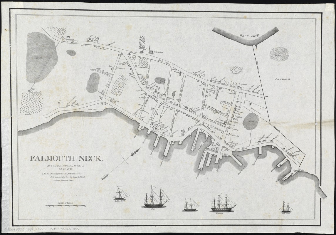
- Falmouth Neck : as it was when destroyed by Mowett, Oct. 18, 1775
- Creator:
- Willis, William, 1794-1870
- Date:
-
[1831]
- Format:
-
Maps/Atlases
- Location:
-
Boston Public Library
Norman B. Leventhal Map Center - Collection (local):
-
Norman B. Leventhal Map Center Collection
- Subjects:
-
Portland (Me.)--History--Revolution, 1775-1783--Maps
Falmouth (Me.)--History--Burning by the British, 1775--Maps
Mowat, Henry, 1734-1798
- Places:
-
Cumberland (county)Portland
Cumberland (county)Falmouth
- Extent:
- 1 map ; 42 x 61 cm.
- Terms of Use:
-
No known copyright restrictions.
No known restrictions on use.
- Publisher:
-
Portland, Maine :
William Willis
- Scale:
-
Scale [ca. 1:1,850]
- Language:
-
English
- Notes:
-
Shows buildings that were destroyed during the burning of Falmouth.
Oriented with north to the upper right.
Engravings of the British vessels Spitfire Bomb, Cat, [unnamed], Canceau and Store commanded by Henry Mowat who ordered the bombardment of Falmouth Neck.
- Notes (date):
-
This date is inferred.
- Identifier:
-
06_01_008290
- Call #:
-
G3734.P8S3 1831 .W55
- Barcode:
-
39999065651455


