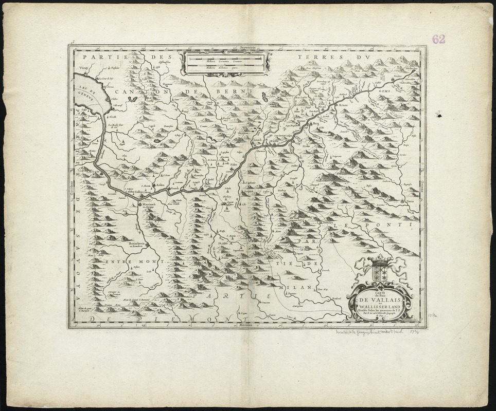
Carte du païs de Vallais, ou Wallis Der-Land
Item Information
- Title:
- Carte du païs de Vallais, ou Wallis Der-Land
- Title (alt.):
-
Collection of old maps
- Creator:
- Duval, P. (Pierre), 1619-1682
- Name on Item:
-
dressée selon les memoires de I.S. par P. du Val d'Abbeville ...
- Date:
-
[1675]
- Format:
-
Maps/Atlases
- Location:
-
Boston Public Library
Norman B. Leventhal Map Center - Collection (local):
-
Norman B. Leventhal Map Center Collection
- Subjects:
-
Valais (Switzerland)--Maps--Early works to 1800
- Places:
-
SwitzerlandValais (canton)
- Extent:
- 1 map ; 35 x 45 cm.
- Terms of Use:
-
No known copyright restrictions.
No known restrictions on use.
- Publisher:
-
Amstelodami :
Apud Ioannem Ianssonium
- Scale:
-
Scale [ca. 1:200,000]
- Language:
-
Latin
- Notes:
-
Map of the Vallais region in southern Switzerland.
Relief shown pictorially.
Includes coat of arms.
From Jansson's Atlas Maior, vol. 4. Amstelodami : Apud Ioannem Ianssonium, [1675].
Verso: Latin text with title "Vallesia."
Cataloging, conservation, and digitization made possible in part by The National Endowment for the Humanities: Exploring the human endeavor.
Part of composite portfolio atlas with title "Collection of old maps."
- Notes (date):
-
This date is inferred.
- Identifier:
-
06_01_009949
- Call #:
-
G1015 .C651 1630
- Barcode:
-
30000003914797


