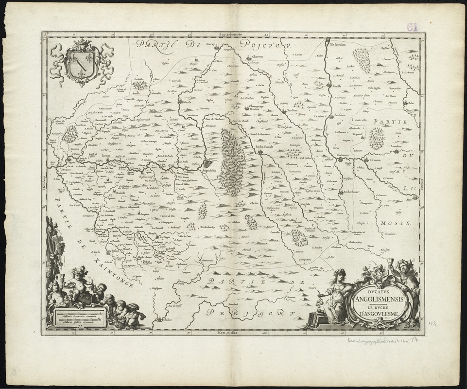
Ducatus Angolismensis = Le Duche d'Angovlesme
Item Information
- Title:
- Ducatus Angolismensis = Le Duche d'Angovlesme
- Title (alt.):
-
Collection of old maps
Le Duche d'Angovlesme
- Creator:
- Jansson, Jan, 1588-1664
- Date:
-
[1675]
- Format:
-
Maps/Atlases
- Location:
-
Boston Public Library
Norman B. Leventhal Map Center - Collection (local):
-
Norman B. Leventhal Map Center Collection
- Subjects:
-
Poitou-Charentes (France)--Maps--Early works to 1800
Angoulême (France)--Maps--Early works to 1800
- Places:
-
FrancePoitou-Charentes (region)
FranceNouvelle-Aquitaine (region)Angoulême
- Extent:
- 1 map ; 40 x 51 cm.
- Terms of Use:
-
No known copyright restrictions.
No known restrictions on use.
- Publisher:
-
Amstelodami :
Apud Ioannem Ianssonium
- Scale:
-
Scale [ca. 1:200,000]
- Language:
-
Latin
- Notes:
-
Map of the historical Duchy of Angoulême in the present day Poitou-Charentes region of western France.
Relief shown pictorially.
Illustrated title cartouche, scale, and coat of arms.
From Jansson's Atlas Maior, vol. 4. Amstelodami : Apud Ioannem Ianssonium, [1675].
Verso: Latin text with title "Ducatus Angolismensis."
Cataloging, conservation, and digitization made possible in part by The National Endowment for the Humanities: Exploring the human endeavor.
Part of composite portfolio atlas with title "Collection of old maps."
- Notes (date):
-
This date is inferred.
- Identifier:
-
06_01_009950
- Call #:
-
G1015 .C651 1630
- Barcode:
-
30000003914795