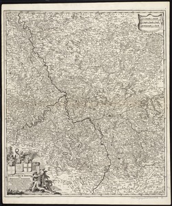
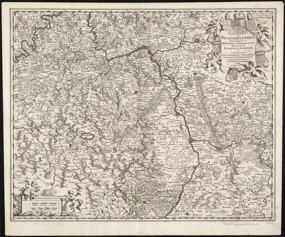
Electoratus et Palatinatus Rheni Episcopatuum Spirensis et Wormacensis ducatuum Bipontii et Simmerae et Comitatuum Sponheimensis Veldensis Leiningensis Bircofeldensis et Rhenograviorum etc. nova tabula accurate descriptia et edita
Item Information
- Title:
- Electoratus et Palatinatus Rheni Episcopatuum Spirensis et Wormacensis ducatuum Bipontii et Simmerae et Comitatuum Sponheimensis Veldensis Leiningensis Bircofeldensis et Rhenograviorum etc. nova tabula accurate descriptia et edita
- Title (alt.):
-
Collection of old maps
- Creator:
- Wit, Frederik de.
- Name on Item:
-
per F. de Wit.
- Date:
-
1680
- Format:
-
Maps/Atlases
- Location:
-
Boston Public Library
Norman B. Leventhal Map Center - Collection (local):
-
Norman B. Leventhal Map Center Collection
- Subjects:
-
Germany--Maps--Early works to 1800
Rhineland-Palatinate (Germany)--Maps--Early works to 1800
- Places:
-
Germany
Rhineland Palatinate
- Extent:
- 1 map ; 46 x 58 cm.
- Terms of Use:
-
No known copyright restrictions.
No known restrictions on use.
- Publisher:
-
Amstelodami :
F. de Wit
- Scale:
-
Scale [ca. 1:350,000]
- Language:
-
Latin
- Notes:
-
Map of the historical Rhine Electorate in the present-day region of Rhineland-Palatinate Germany.
Relief shown pictorially.
Illustrated title cartouche.
Cataloging, conservation, and digitization made possible in part by The National Endowment for the Humanities: Exploring the human endeavor.
Part of composite portfolio atlas with title "Collection of old maps."
- Identifier:
-
06_01_009899
- Call #:
-
G1015 .C651 1630
- Barcode:
-
30000003905246