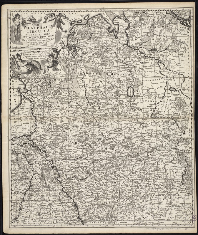
S.R.I. Westphaliae circulus, in omnes ejusdem subjacentes provincias exactissime distinctus
Item Information
- Title:
- S.R.I. Westphaliae circulus, in omnes ejusdem subjacentes provincias exactissime distinctus
- Title (alt.):
-
Collection of old maps
- Creator:
- Visscher, Nicolaes, 1649-1702
- Name on Item:
-
per Nicolaum Visscher.
- Date:
-
[ca. 1689]
- Format:
-
Maps/Atlases
- Location:
-
Boston Public Library
Norman B. Leventhal Map Center - Collection (local):
-
Norman B. Leventhal Map Center Collection
- Subjects:
-
North Rhine-Westphalia (Germany)--Maps--Early works to 1800
Lower Saxony (Germany)--Maps--Early works to 1800
- Places:
-
North Rhine-Westphalia
Lower Saxony
- Extent:
- 1 map ; 58 x 49 cm.
- Terms of Use:
-
No known copyright restrictions.
No known restrictions on use.
- Publisher:
-
Amstelaedami :
Apud Nicolaum Visscher
- Scale:
-
Scale [ca. 1:660,000]
- Language:
-
Latin
- Notes:
-
Map of the regions of Lower Saxony and Westphalia in Germany, and part of eastern Netherlands.
Relief shown pictorially.
Includes reference grid.
May have appeared in Visscher's Atlas Minor. Amstelaedami : Apud Nicolaum Visscher cum Privil: Ordin: General: Belgii Foederati
In Latin.
Cataloging, conservation, and digitization made possible in part by The National Endowment for the Humanities: Exploring the human endeavor.
Part of composite portfolio atlas with title "Collection of old maps."
- Identifier:
-
06_01_009648
- Call #:
-
G1015 .C651 1630
- Barcode:
-
30000003874639
![Ducatus Brunsvicensis fere[que] Lunaeburgensis, cum adjacentibus Episcopatibus, Comit. Domin. etc., descriptio geographica](https://bpldcassets.blob.core.windows.net/derivatives/images/commonwealth:cj82kr74v/image_thumbnail_300.jpg)