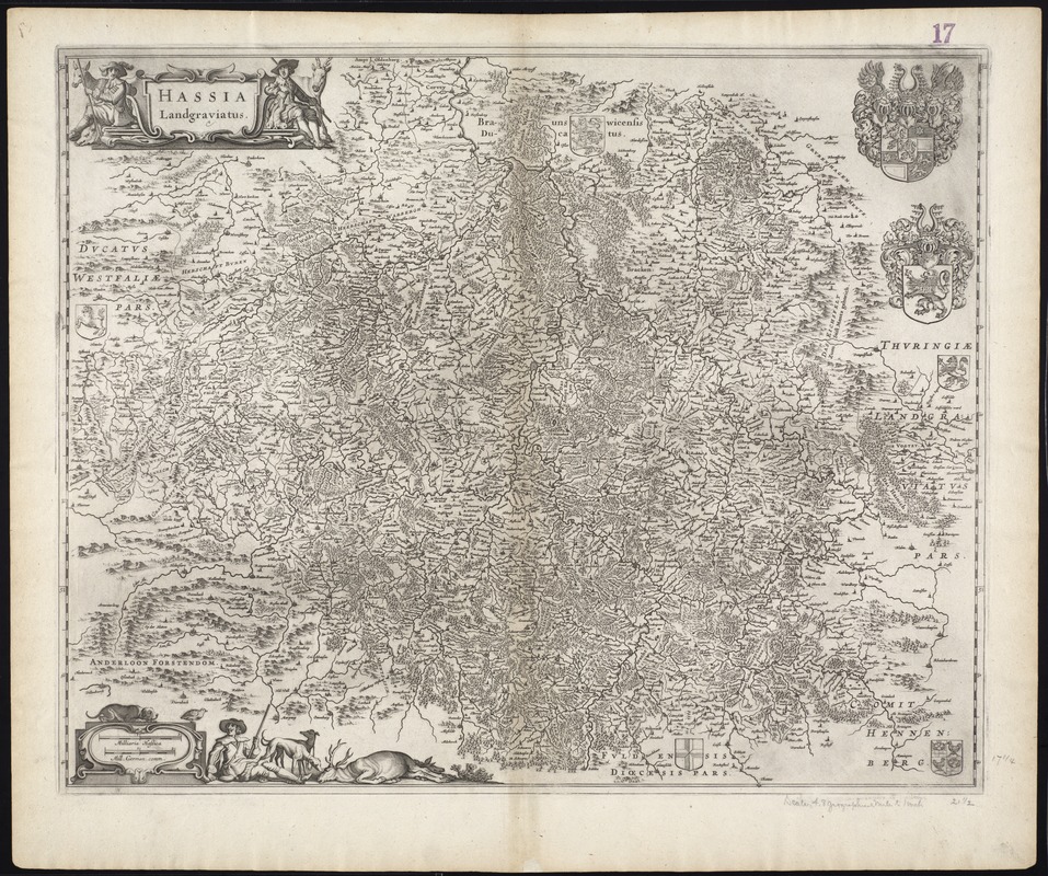
Hassia Landgraviatus
Item Information
- Title:
- Hassia Landgraviatus
- Title (alt.):
-
Collection of old maps
- Creator:
- Blaeu, Joan, 1596-1673
- Date:
-
[1645?]
- Format:
-
Maps/Atlases
- Location:
-
Boston Public Library
Norman B. Leventhal Map Center - Collection (local):
-
Norman B. Leventhal Map Center Collection
- Subjects:
-
Hesse (Germany)--Maps--Early works to 1800
North Rhine-Westphalia (Germany)--Maps--Early works to 1800
- Places:
-
North Rhine-Westphalia
Hesse
- Extent:
- 1 map ; 45 x 55 cm.
- Terms of Use:
-
No known copyright restrictions.
No known restrictions on use.
- Publisher:
-
Amsterdam? :
Joan Blaeu?
- Scale:
-
Scale [ca. 1:356,000]
- Language:
-
Latin
- Notes:
-
Map of the Hesse region in central Germany.
Relief shown pictorially.
Bar scales given in "milliaria Hassica" and "mill. German. comm."
Cataloging, conservation, and digitization made possible in part by The National Endowment for the Humanities: Exploring the human endeavor.
Part of composite portfolio atlas with title "Collection of old maps."
- Identifier:
-
06_01_009627
- Call #:
-
G1015 .C651 1630
- Barcode:
-
30000003873703