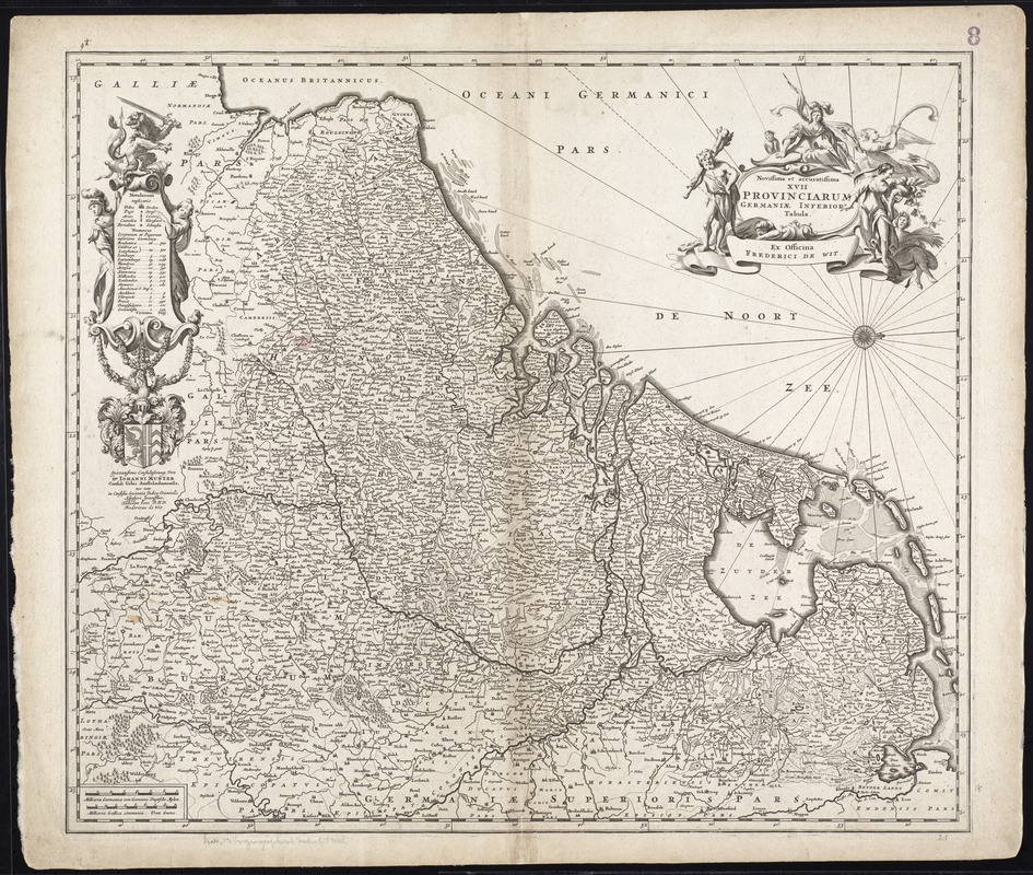
Novissima et accuratissima XVII provinciarum Germaniae inferioris tabula
Item Information
- Title:
- Novissima et accuratissima XVII provinciarum Germaniae inferioris tabula
- Title (alt.):
-
Collection of old maps
- Creator:
- Wit, Frederik de.
- Date:
-
[1680]
- Format:
-
Maps/Atlases
- Location:
-
Boston Public Library
Norman B. Leventhal Map Center - Collection (local):
-
Norman B. Leventhal Map Center Collection
- Subjects:
-
Benelux countries--Maps--Early works to 1800
- Places:
-
Low Countries (area)
- Extent:
- 1 map ; 47 x 54 cm.
- Terms of Use:
-
No known copyright restrictions.
No known restrictions on use.
- Publisher:
-
[Amstelodami] :
Ex officina Frederick de Wit
- Scale:
-
Scale [ca. 1:950,000]
- Language:
-
Latin
- Notes:
-
Map of the Benelux countries.
Oriented with north to the right.
Relief shown pictorially.
Date supplied by Koeman, v. 5, p. 210, col. 2.
Dedicated to Johannes Munter by F. de Wit.
Cataloging, conservation, and digitization made possible in part by The National Endowment for the Humanities: Exploring the human endeavor.
Part of composite portfolio atlas with title "Collection of old maps."
- Notes (date):
-
This date is inferred.
- Identifier:
-
06_01_009602
- Call #:
-
G1015 .C651 1630
- Barcode:
-
30000003873355