Weller's political map of the United States : showing the plurality vote of the presidential election of 1892, in all states and counties
Item Information
- Title:
- Weller's political map of the United States : showing the plurality vote of the presidential election of 1892, in all states and counties
- Title (alt.):
-
Political map of the U.S
- Description:
-
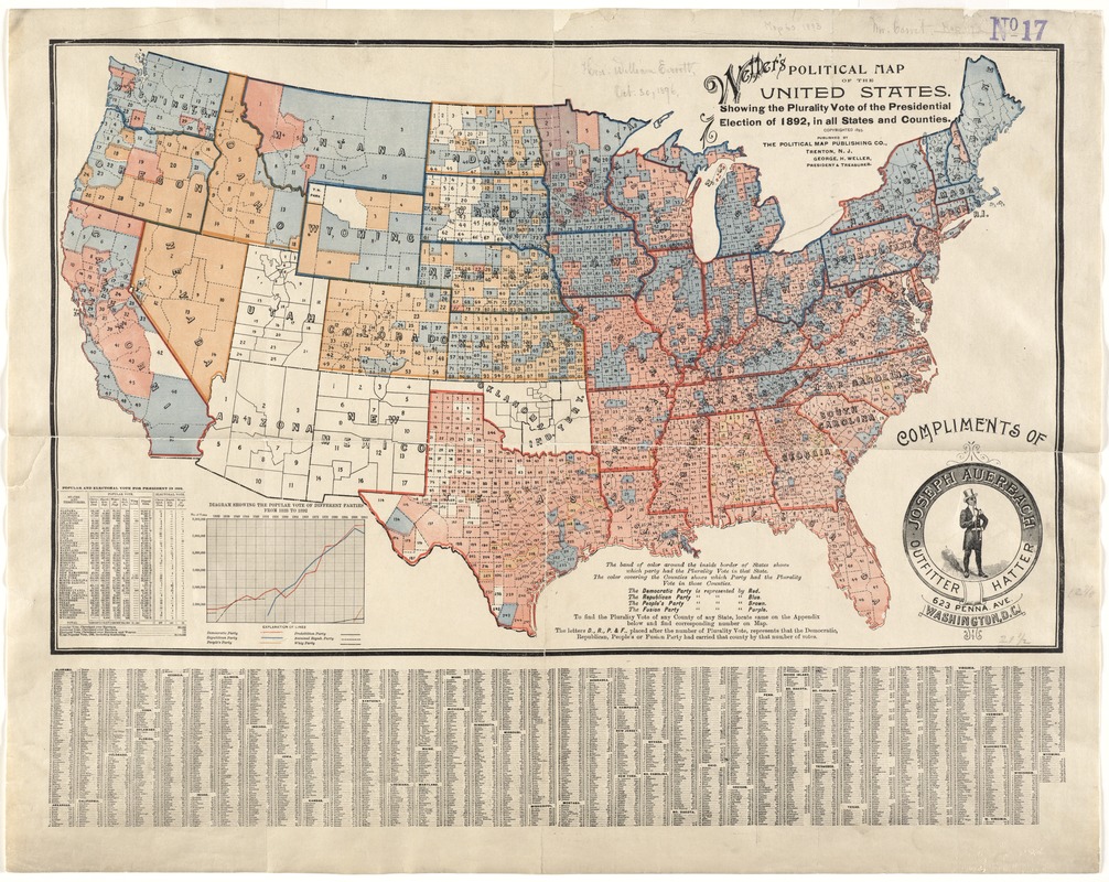
Prepared after the 1892 election, which pitted Republican Benjamin Harrison against Democrat Grover Cleveland for a second time, this map displayed the pluralities or majorities at both the county and state levels. Counties were shaded red, blue, or brown to signify Democratic, Republican, or Peoples party majorities. State boundaries were highlighted with the appropriate party color to indicate majorities for the entire state. In contrast to the 1888 election when Harrison won the electoral vote but not the popular vote, Cleveland won both the electoral and popular vote in 1892.
- Creator:
- Weller, George H.
- Date:
-
[ca. 1893]
- Format:
-
Maps/Atlases
- Location:
-
Boston Public Library
Norman B. Leventhal Map Center - Collection (local):
-
Norman B. Leventhal Map Center Collection
- Subjects:
-
United States--Politics and government--1889-1893--Maps
1892
- Places:
-
- Extent:
- 1 map : col. ; 33 x 55 cm., folded to 16 x 10 cm.
- Terms of Use:
-
No known copyright restrictions.
No known restrictions on use.
- Publisher:
-
Trenton, N.J :
Published by the Political Map Pub. Co.
- Scale:
-
Scale indeterminable.
- Language:
-
English
- Notes:
-
No relief indicated.
Cover title: Weller's bird's-eye political-color map of the United States.
Includes index.
- Notes (exhibitions):
-
Exhibited: "America Votes: Mapping the Political Landscape" organized by the Norman B. Leventhal Map Center at the Boston Public Library, 2012.
- Identifier:
-
06_01_008661
- Call #:
-
G3701.F9 1892 .W4
- Barcode:
-
39999065651117


