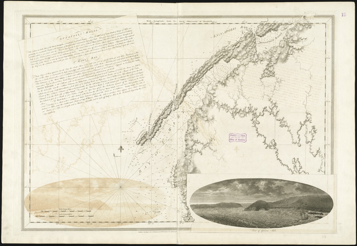
Annapolis Royal ... : St. Mary's Bay
This map is also available in American Revolutionary Geographies Online (ARGO), a collections portal especially built for material relating to the American Revolutionary War Era. Visit ARGO to learn more about this item and explore the historical geography of North America in the late eighteenth century.
Item Information
- Title:
- Annapolis Royal ... : St. Mary's Bay
- Title (alt.):
-
St. Mary's Bay
- Creator:
- Des Barres, Joseph F. W. (Joseph Frederick Wallet), 1722-1824
- Date:
-
1776
- Format:
-
Maps/Atlases
- Location:
-
Boston Public Library
Norman B. Leventhal Map Center - Collection (local):
-
Norman B. Leventhal Map Center Collection
- Subjects:
-
Nautical charts--Nova Scotia--Saint Mary Bay--Early works to 1800
Saint Mary Bay (N.S.)--Maps--Early works to 1800
Annapolis Royal Region (N.S.)--Maps--Early works to 1800
- Places:
-
CanadaSaint Marys Bay
CanadaAnnapolis Royal
- Extent:
- 1 chart ; 72 x 100 cm.
- Terms of Use:
-
No known copyright restrictions.
No known restrictions on use.
- Publisher:
-
[London] :
Published according to an Act of Parliament by I.F.W. Desbarres
- Edition:
- 2nd state.
- Scale:
-
Scale [ca. 1:120,000]
- Language:
-
English
- Notes:
-
Relief shown by hachures and shading. Depths shown by soundings.
Appears in the author's Atlantic Neptune. London : J.F.W. Des Barres, 1777-[1781].
Inset: "View of Gulivers Hole."
- Identifier:
-
06_01_008164
- Call #:
-
G1106.P5 D47 1777
- Barcode:
-
30000003793026


