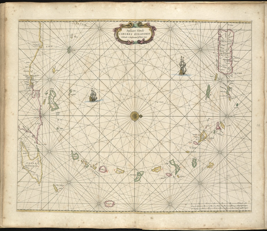
Pascaert vande Caribes Eylanden
Item Information
- Title:
- Pascaert vande Caribes Eylanden
- Creator:
- Goos, Pieter, ca. 1616-1675
- Date:
-
1672
- Format:
-
Maps/Atlases
- Location:
-
Boston Public Library
Norman B. Leventhal Map Center - Collection (local):
-
Norman B. Leventhal Map Center Collection
- Subjects:
-
Nautical charts--Antilles, Lesser--Early works to 1800
Antilles, Lesser--Maps--Early works to 1800
- Places:
-
Lesser Antilles (area)
- Extent:
- 1 map : hand col. ; 43 x 54 cm.
- Terms of Use:
-
No known copyright restrictions.
No known restrictions on use.
- Publisher:
-
t'Amsteldam :
By Pieter Goos
- Scale:
-
Scale [ca. 1:2,050,000].
- Language:
-
Dutch
- Notes:
-
Depths shown by soundings.
Oriented with north to the right.
Appears in the author's De zee-atlas ofte water-wereld. Amsteldam: Pieter Goos, 1672.
Cataloging, conservation, and digitization made possible in part by The National Endowment for the Humanities: Exploring the human endeavor.
Atlas scanned by Internet Archive http://archive.org/details/dezeeatlasoftewa00goos
- Identifier:
-
06_01_007927
- Call #:
-
G1059 .G66 1672
- Barcode:
-
30000003773587


![[Alleen de Caribische Eilanden, vervat in 't groot]](https://bpldcassets.blob.core.windows.net/derivatives/images/commonwealth:st74cw59p/image_thumbnail_300.jpg)

