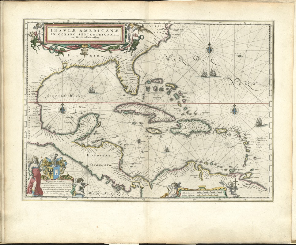
Insulae Americanae in Oceano Septentrionali, cum terris adiacentibus
Item Information
- Title:
- Insulae Americanae in Oceano Septentrionali, cum terris adiacentibus
- Creator:
- Blaeu, Willem Janszoon, 1571-1638
- Date:
-
[1650]
- Format:
-
Maps/Atlases
- Location:
-
Boston Public Library
Norman B. Leventhal Map Center - Collection (local):
-
Norman B. Leventhal Map Center Collection
- Subjects:
-
West Indies--Maps--Early works to 1800
Caribbean Area--Maps--Early works to 1800
- Places:
-
West Indies
Caribbean Sea
- Extent:
- 1 map : hand col. ; 37 x 51 cm.
- Terms of Use:
-
No known copyright restrictions.
No known restrictions on use.
- Publisher:
-
Amsterdam :
Chez Iean Blaev
- Scale:
-
Scale ca. 1:9,500,000.
- Language:
-
Latin
- Notes:
-
Along with the islands in the Caribbean, shows the southern coast of the United States, the Gulf of Mexico, the Central American coast, and the north coast of South America.
Appears in the author's Le theatre du monde, ou, Nouuel atlas. Amsterdam: Chez Iean Blaev, 1650.
Cataloging, conservation, and digitization made possible in part by The National Endowment for the Humanities: Exploring the human endeavor.
Atlas scanned by Internet Archive http://archive.org/details/letheatredumonde00blae
- Notes (date):
-
This date is inferred.
- Identifier:
-
06_01_007852
- Call #:
-
G1015 .B53 1650
- Barcode:
-
30000003768929


