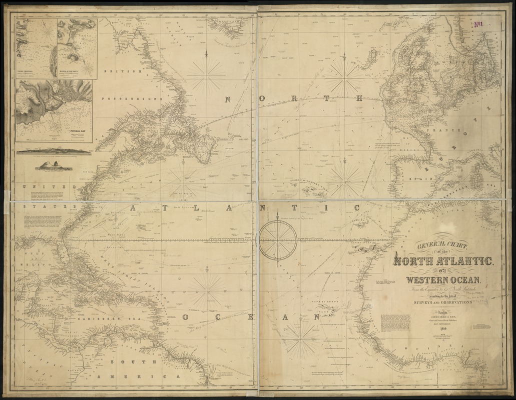
General chart, of the North Atlantic, or Western Ocean, from the equator to 62° north latitude, according to the latest, surveys and observations
Item Information
- Title:
- General chart, of the North Atlantic, or Western Ocean, from the equator to 62° north latitude, according to the latest, surveys and observations
- Creator:
- James Imray and Son
- Date:
-
1859
- Format:
-
Maps/Atlases
- Location:
-
Boston Public Library
Norman B. Leventhal Map Center - Collection (local):
-
Norman B. Leventhal Map Center Collection
- Subjects:
-
North Atlantic Ocean--Maps
- Places:
-
Atlantic Ocean
- Extent:
- 1 map : 97 x 128 cm.
- Terms of Use:
-
No known copyright restrictions.
No known restrictions on use.
- Publisher:
-
London :
James Imray & Son
- Scale:
-
Scale 1:9,000,000.
- Language:
-
English
- Notes:
-
Relief shown by hachures. Depths shown by soundings.
Insets: Fayal Channel, Horta & Pim Bays, and Funchal Bay.
Includes two coastal profiles and ocean currents.
- Identifier:
-
06_01_007715
- Call #:
-
G9110 1859 .J36x
- Barcode:
-
39999065647438