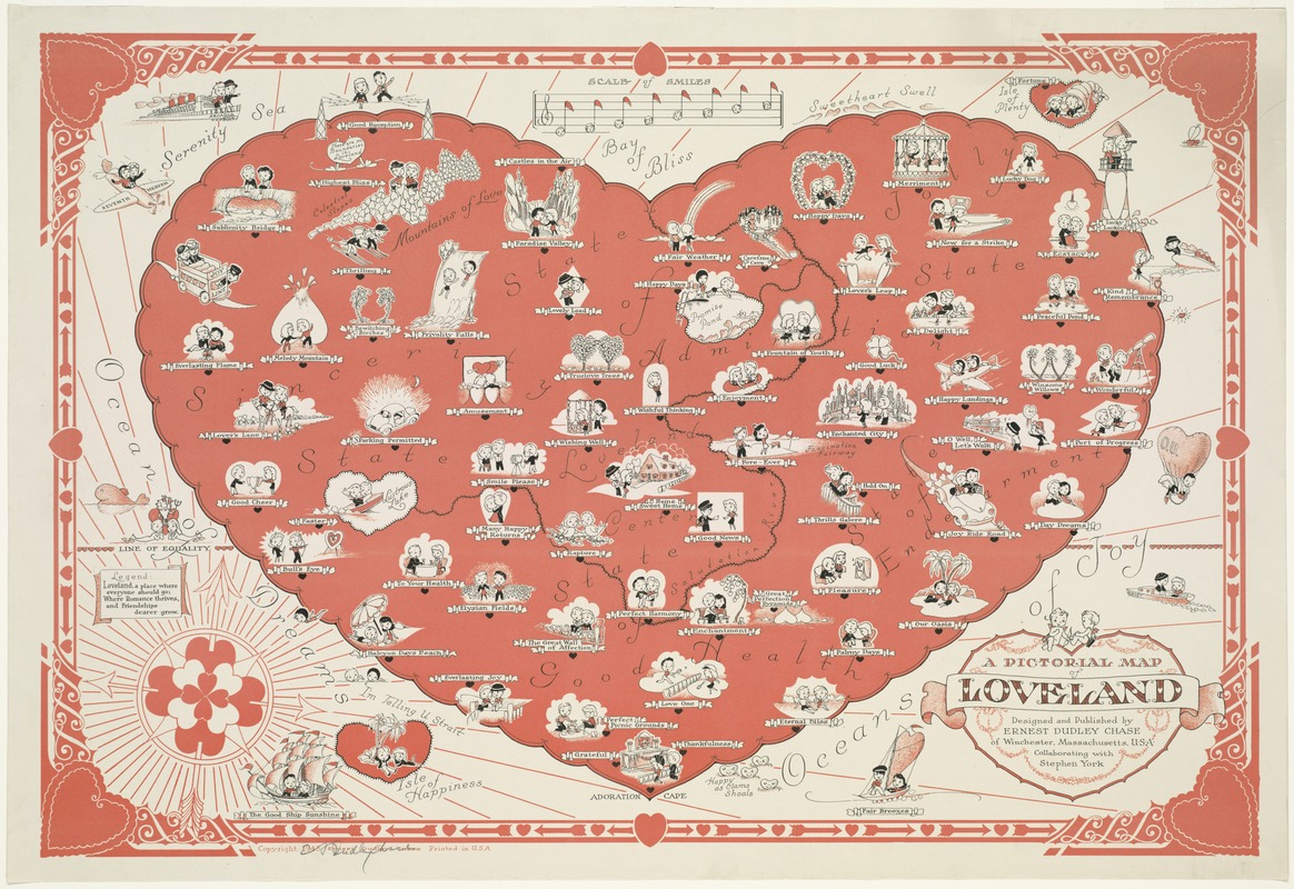
A pictorial map of loveland
Item Information
- Title:
- A pictorial map of loveland
- Description:
-
During his career as a greeting card designer, Chase published approximately fifty pictorial maps, generally displaying a sense of humor. While most used illustrations to highlight geographical information in real places, he also created maps of imaginary places. This fictitious map of a heart-shaped place called Loveland merged the sentimentality of greeting cards with standard cartographic conventions. Loveland was appropriately portrayed with meticulously drawn and cleverly labeled images. From its decorative border to conventional map elements, Chase completely committed to the theme of love. Even the compass rose was composed of a cluster of hearts pieced by three arrows.
- Creator:
- Chase, Ernest Dudley, 1878-
- Name on Item:
-
designed and published by Ernest Dudley Chase of Winchester, Massachusetts, U.S.A., collaborating with Stephen York.
- Date:
-
[ca. 1943]
- Format:
-
Maps/Atlases
- Location:
-
Boston Public Library
Norman B. Leventhal Map Center - Collection (local):
-
Norman B. Leventhal Map Center Collection
- Subjects:
-
Love--Maps
Imaginary places--Maps
- Extent:
- 1 map : col. ; on sheet 40 x 58 cm.
- Terms of Use:
-
No known copyright restrictions.
No known restrictions on use.
- Publisher:
-
Winchester, Mass :
Ernest Dudley Chase
- Scale:
-
Scale not given.
- Language:
-
English
- Notes:
-
Pictorial map.
Relief shown pictorially.
Includes col. ill. and text.
"Loveland, a place where everyone should go; Where romance thrives, and Friendships dearer grow."
- Notes (exhibitions):
-
Exhibited: "Unconventional Maps: Exploring the Stories of Cartographic Curiosities" organized by the Norman B. Leventhal Map Center at the Boston Public Library, 2011-2012.
- Identifier:
-
06_01_007671
- Call #:
-
G9930 1943 .C43
- Barcode:
-
39999065646935