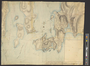
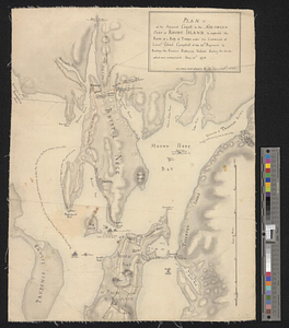
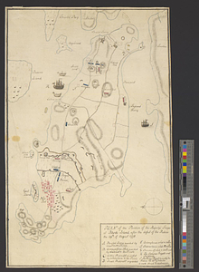
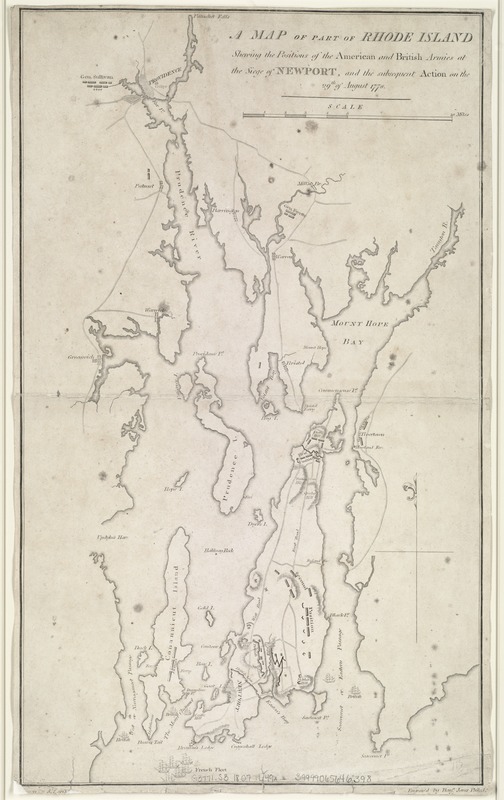
A map of part of Rhode Island shewing the positions of the American and British armies at the Siege of Newport, and the subsequent action on the 29th of August 1778
Item Information
- Title:
- A map of part of Rhode Island shewing the positions of the American and British armies at the Siege of Newport, and the subsequent action on the 29th of August 1778
- Creator:
- Lewis, Samuel, 1753 or 4-1822
- Name on Item:
-
drawn by S. Lewis ; engrav'd by Benjn. Jones.
- Date:
-
[1807]
- Format:
-
Maps/Atlases
- Location:
-
Boston Public Library
Norman B. Leventhal Map Center - Collection (local):
-
Norman B. Leventhal Map Center Collection
- Subjects:
-
Rhode Island, Battle of, R.I., 1778--Maps
Rhode Island--History--Revolution, 1775-1783--Maps
- Places:
-
Newport (county)Rhode Island (island)
- Extent:
- 1 map ; 42 x 25 cm.
- Terms of Use:
-
No known copyright restrictions.
No known restrictions on use.
- Publisher:
-
Philadelphia :
C.P. Wayne
- Scale:
-
Scale ca. 1:140,000.
- Language:
-
English
- Notes:
-
Relief shown by hachures.
Appears in John Marshall's The life of George Washington, maps and subscriber's names. Philadelphia : C.P. Wayne, 1807.
Leventhal Map Center copy gift of Bank of America.
- Notes (date):
-
This date is inferred.
- Identifier:
-
06_01_007648
- Call #:
-
G3771.S3 1807 .L49x
- Barcode:
-
39999065646398