Map of the United States and territories, showing the extent of public surveys and other details
Item Information
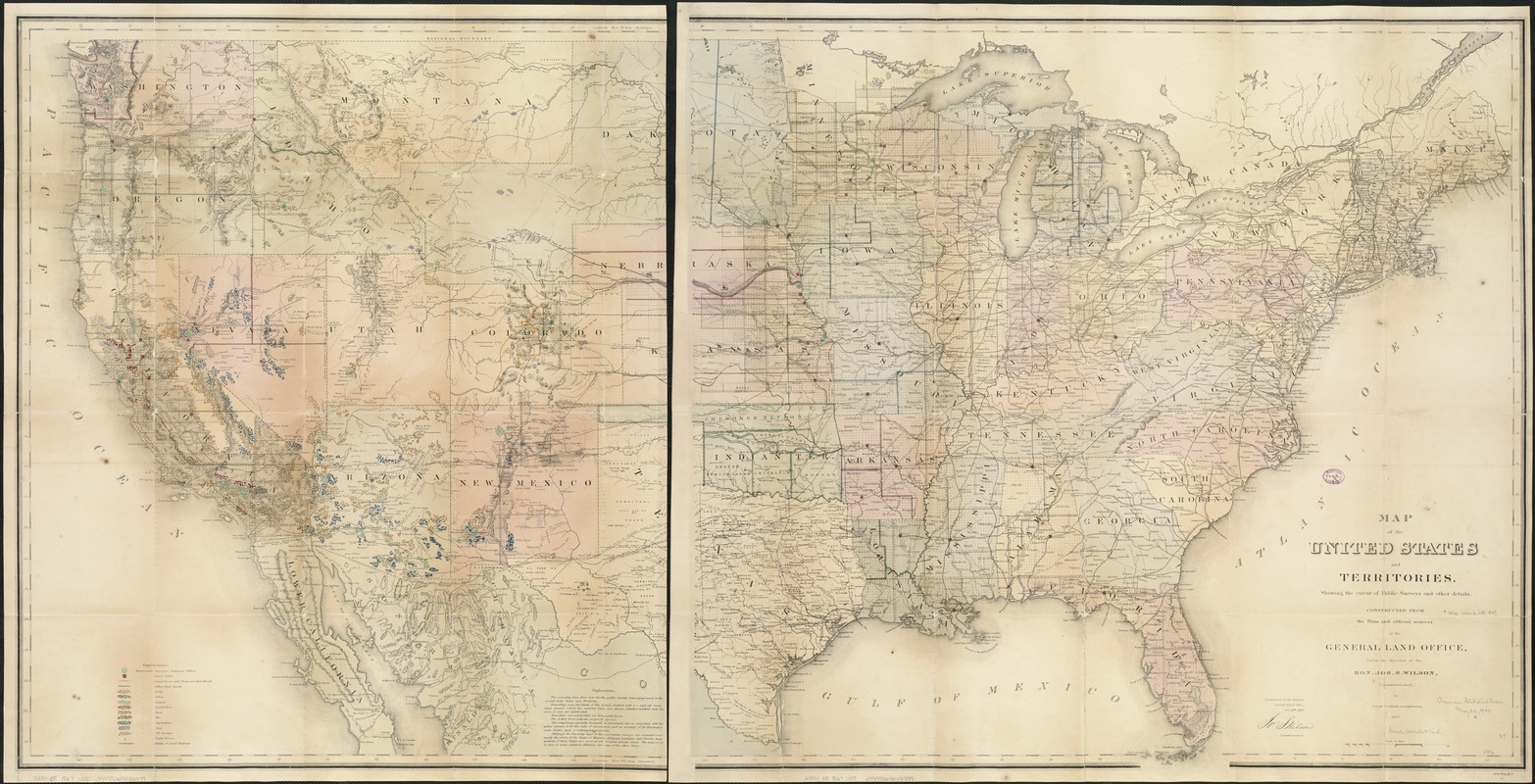
- Title:
- Map of the United States and territories, showing the extent of public surveys and other details
- Creator:
- United States. General Land Office
- Name on Item:
-
constructed from the plats and official sources of the General Land Office, under the direction of Jos. S. Wilson, commissioner, by Joseph Gorlinski, draughtsman, 1867 ; Department of the Interior, General Land Office, Oct. 15th, 1867.
- Date:
-
[1867]
- Format:
-
Maps/Atlases
- Location:
-
Boston Public Library
Norman B. Leventhal Map Center - Collection (local):
-
Norman B. Leventhal Map Center Collection
- Subjects:
-
Mines and mineral resources--United States--Maps
United States--Surveys
- Places:
-
- Extent:
- 1 map on 2 sheets : hand col. ; 71 x 138 cm., on sheets 74 x 80 cm.
- Terms of Use:
-
No known copyright restrictions.
No known restrictions on use.
- Publisher:
-
[Washington, D.C.] :
The Office
- Scale:
-
Scale [ca. 1:3,800,000]
- Language:
-
English
- Notes:
-
Relief shown by hachures.
Also shows mine and mineral resources and Surveyor General and Land Office locations.
From the General Land Office annual report, 1867.
Includes notes.
- Notes (date):
-
This date is inferred.
- Identifier:
-
06_01_007884
- Call #:
-
G3701.B5 1867 .U55
- Barcode:
-
39999065646299
- LCCN:
-
83691754


