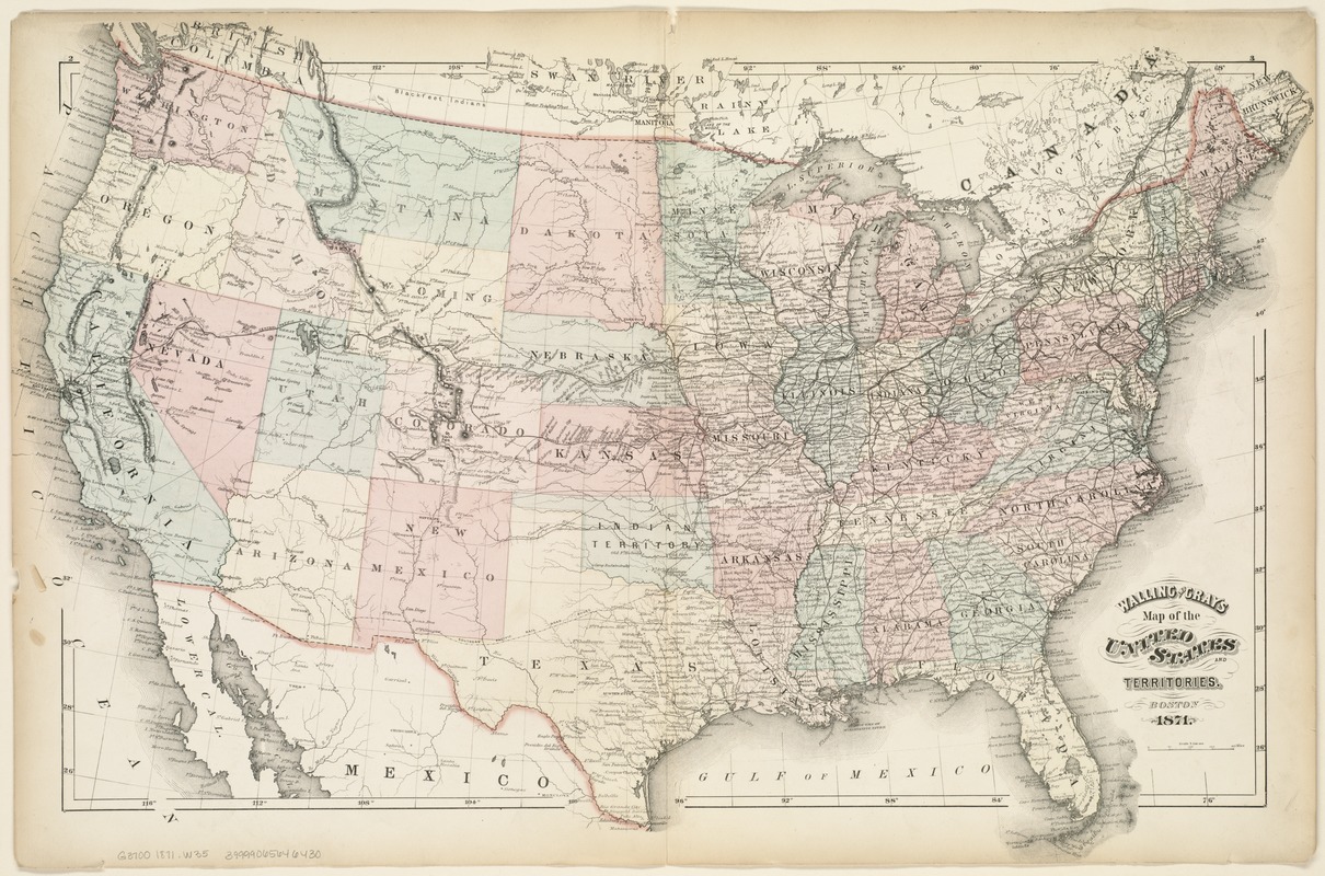
Walling and Gray's map of the United States and territories
Item Information
- Title:
- Walling and Gray's map of the United States and territories
- Title (alt.):
-
Map of the United States and territories
- Creator:
- Walling & Gray (Firm)
- Date:
-
1871
- Format:
-
Maps/Atlases
- Location:
-
Boston Public Library
Norman B. Leventhal Map Center - Collection (local):
-
Norman B. Leventhal Map Center Collection
- Subjects:
-
United States--Maps
- Places:
-
- Extent:
- 1 map : hand col. ; 42 x 65 cm.
- Terms of Use:
-
No known copyright restrictions.
No known restrictions on use.
- Publisher:
-
Boston :
[Walling & Gray?]
- Scale:
-
Scale 1:7,500,000
- Language:
-
English
- Notes:
-
Relief shown by hachures and spot heights.
Prime meridian: Greenwich.
Pages "2" and "3" of unknown atlas.
Verso of p. 2: "xxxi" "List of cities, towns, etc."
Leventhal Map Center copy gift of Bank of America.
- Identifier:
-
06_01_007652
- Call #:
-
G3700 1871 .W35
- Barcode:
-
39999065646430


