Springfield : surveyed by direction of the town 1826
Item Information
- Title:
- Springfield : surveyed by direction of the town 1826
- Creator:
- Bowles, Samuel, 1797-1851
- Date:
-
1827
- Format:
-
Maps/Atlases
- Location:
-
Boston Public Library
Norman B. Leventhal Map Center - Collection (local):
-
Norman B. Leventhal Map Center Collection
- Subjects:
-
Springfield (Mass.)--Maps
1827
- Places:
-
Hampden (county)Springfield
- Extent:
- 1 map : ill. ; 46 x 38 cm.
- Terms of Use:
-
No known copyright restrictions.
No known restrictions on use.
- Publisher:
-
[Springfield, Mass.?] :
Published by Samuel Bowles
- Scale:
-
Scale [1:31,680]. "20 rods to 1/8 of an inch".
- Language:
-
English
- Notes:
-
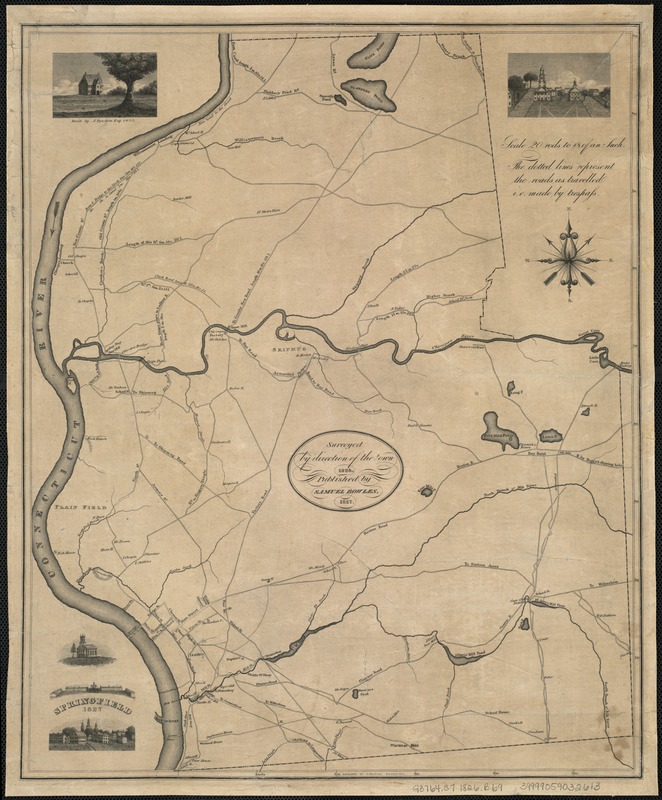
Shows locations of churches, factories, mills, roads, schools, and the names of some property owners.
Uncaptioned illustrations in two corners show churches and the Springfield Armory (?); in a third, a captioned illustration of a house "Built by J. Pynchon 1657."
"The dotted lines represent the roads as travelled i.e. by trespass."
"Engraved by O. Pelton, Hartford."
- Identifier:
-
06_01_007516
- Call #:
-
G3764.S7 1826 .B69
- Barcode:
-
39999059032613


