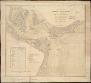
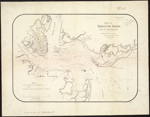
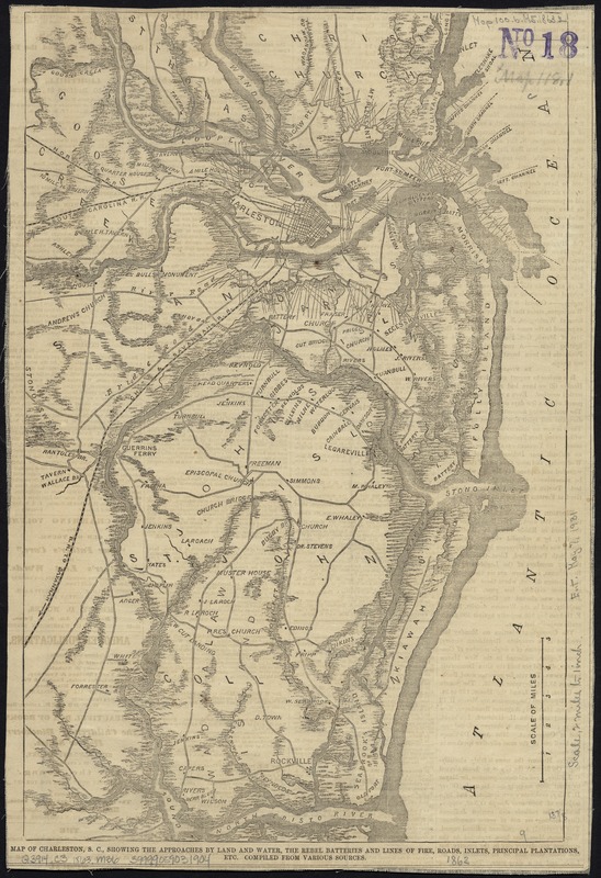
Map of Charleston, S.C., showing the approaches by land and water, the rebel batteries and lines of fire, roads, inlets, principal plantations, etc
Item Information
- Title:
- Map of Charleston, S.C., showing the approaches by land and water, the rebel batteries and lines of fire, roads, inlets, principal plantations, etc
- Name on Item:
-
compiled from various sources.
- Date:
-
[1863]
- Format:
-
Maps/Atlases
- Location:
-
Boston Public Library
Norman B. Leventhal Map Center - Collection (local):
-
Norman B. Leventhal Map Center Collection
- Subjects:
-
Charleston Region (S.C.)--History--19th century--Maps
Charleston Harbor (S.C.)--Maps
- Places:
-
Charleston (county)Charleston Harbor (bay)
Charleston (county)Charleston
- Extent:
- 1 map : col. ; 36 x 24 cm.
- Terms of Use:
-
No known copyright restrictions.
No known restrictions on use.
- Publisher:
-
New York :
Harper's Magazine Co.
- Scale:
-
Scale [ca. 1:126,720]
- Language:
-
English
- Notes:
-
Detached from: Harper's weekly (Mar. 28, 1863).
- Notes (date):
-
This date is inferred.
- Identifier:
-
06_01_007491
- Call #:
-
G3914.C3 1863 .M36
- Barcode:
-
39999059031904