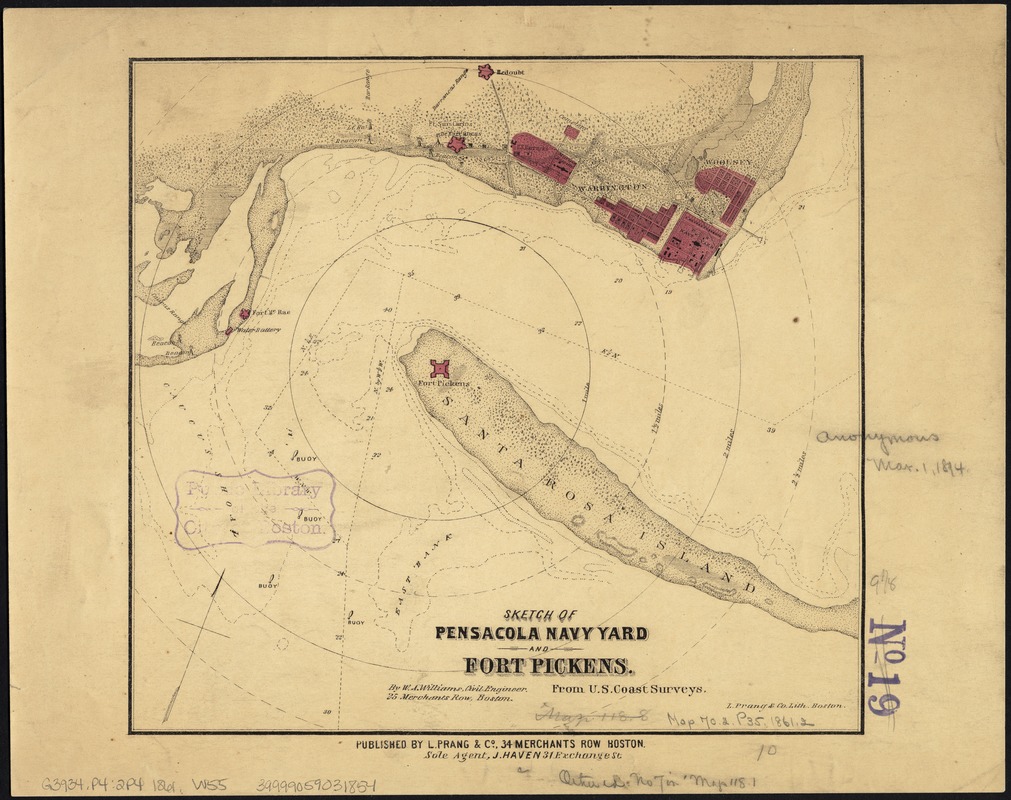
Sketch of Pensacola Navy Yard and Fort Pickens from U.S. coast surveys
Item Information
- Title:
- Sketch of Pensacola Navy Yard and Fort Pickens from U.S. coast surveys
- Creator:
- Williams, W. A.
- Name on Item:
-
By W. A. Williams, Civil Engineer.
- Date:
-
[1860–1869]
- Format:
-
Maps/Atlases
- Location:
-
Boston Public Library
Norman B. Leventhal Map Center - Collection (local):
-
Norman B. Leventhal Map Center Collection
- Subjects:
-
Pensacola Navy Yard (Fla.)--Maps
Fort Pickens (Fla.)--Maps
- Places:
-
FloridaSanta Rosa (county)Santa Rosa Island (island)Fort Pickens (historic site)
FloridaEscambia (county)Pensacola
Naval Air Station Pensacola
- Extent:
- 1 map : col. ; 25 x 26 cm.
- Terms of Use:
-
No known copyright restrictions.
No known restrictions on use.
- Publisher:
-
Boston :
L. Prang & Co.
- Scale:
-
Scale [ca. 1:31,000]
- Language:
-
English
- Notes:
-
Indicates fortifications, half-mile distance circles centered on Fort Pickens, beacons, roads and streets, vegetation, and a few soundings.
Relief shown by hachures. Depths shown by soundings and isolines.
- Notes (date):
-
This date is inferred.
- Identifier:
-
06_01_007486
- Call #:
-
G3934.P4:2P4 1861 .W55
- Barcode:
-
39999059031854
39999065679241
39999065679233
- LCCN:
-
99447280


