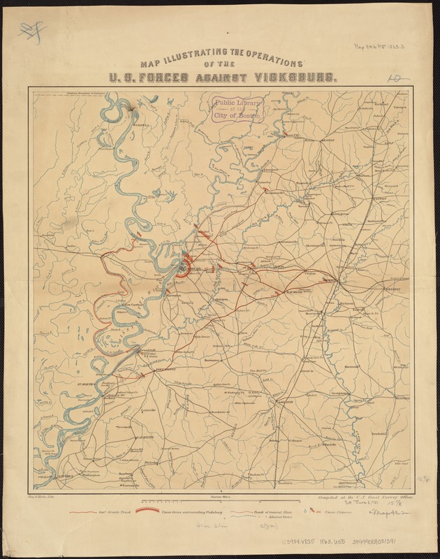
Map illustrating the operations of U.S. Forces against Vicksburg
Item Information
- Title:
- Map illustrating the operations of U.S. Forces against Vicksburg
- Creator:
- United States Coast Survey
- Name on Item:
-
compiled at the U.S. Coast Survey Office ; J.W. Maedel.
- Date:
-
[1863?]
- Format:
-
Maps/Atlases
- Location:
-
Boston Public Library
Norman B. Leventhal Map Center - Collection (local):
-
Norman B. Leventhal Map Center Collection
- Subjects:
-
Vicksburg Region (Miss.)--History--Civil War, 1861-1865--Maps
- Places:
-
Warren (county)Vicksburg
- Extent:
- 1 map : col. ; 43 x 40 cm.
- Terms of Use:
-
No known copyright restrictions.
No known restrictions on use.
- Publisher:
-
[Washington, D.C.] :
The Survey
- Scale:
-
Scale [ca. 1:275,000]
- Language:
-
English
- Notes:
-
Also shows the tracks of Genl. Grant, General Blair, and Admiral Porter, and sites of Union victories.
Relief shown by hachures.
- Identifier:
-
06_01_007437
- Call #:
-
G3984.V8S5 1863 .U55
- Barcode:
-
39999059031391
- LCCN:
-
86691335


