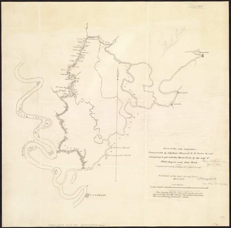
Route of the late expedition commanded by Act'g Rear Admiral D.D. Porter U.S.N. attempting to get into the Yazoo River by the way of Steels Bayou and Deer Creek
Item Information
- Title:
- Route of the late expedition commanded by Act'g Rear Admiral D.D. Porter U.S.N. attempting to get into the Yazoo River by the way of Steels Bayou and Deer Creek
- Creator:
- Strausz, A.
- Name on Item:
-
Compiled and drawn by A. Strausz U.S. Coast Survey.
- Date:
-
1863
- Format:
-
Maps/Atlases
- Location:
-
Boston Public Library
Norman B. Leventhal Map Center - Collection (local):
-
Norman B. Leventhal Map Center Collection
- Subjects:
-
Yazoo River (Miss.)--Maps
United States--History--Civil War, 1861-1865--Maps
Porter, David D. (David Dixon), 1813-1891
- Places:
-
Yazoo River
- Extent:
- 1 map ; 46 x 45 cm.
- Terms of Use:
-
No known copyright restrictions.
No known restrictions on use.
- Publisher:
-
[Washington, D.C.] :
Coast Survey Office
- Scale:
-
Scale 1:210,500.
- Language:
-
English
- Notes:
-
Shows Yazoo River drainage and Mississippi River north of Vicksburg, Mississippi.
Shaded area shows route actually traveled by naval gunboats with remainder of proposed route shown by dotted line.
- Identifier:
-
06_01_007444
- Call #:
-
G3982.Y2S5 1863 .U5
- Barcode:
-
39999059031466
![[Mississippi River near Vicksburg and vicinity]](https://bpldcassets.blob.core.windows.net/derivatives/images/commonwealth:6w924q741/image_thumbnail_300.jpg)


