Colton's new railroad & county map of the United States, the Canadas &c
Item Information
- Title:
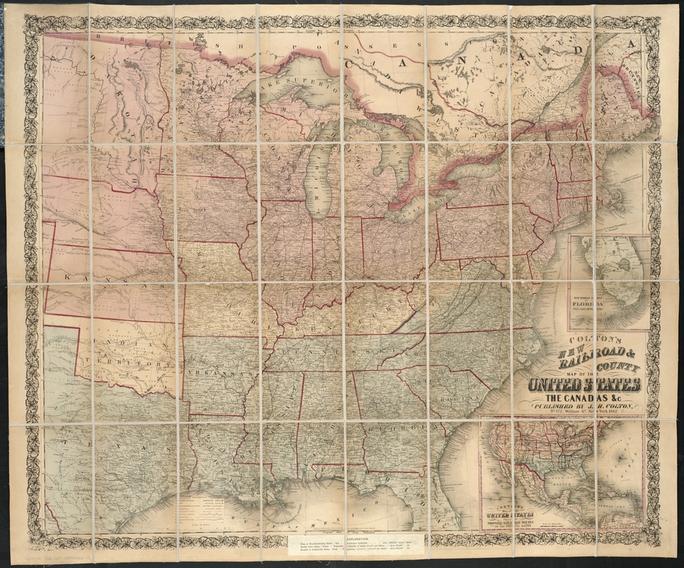
- Colton's new railroad & county map of the United States, the Canadas &c
- Creator:
- Colton, J. H. (Joseph Hutchins), 1800-1893
- Date:
-
1862
- Format:
-
Maps/Atlases
- Location:
-
Boston Public Library
Norman B. Leventhal Map Center - Collection (local):
-
Norman B. Leventhal Map Center Collection
- Subjects:
-
Railroads--United States--Maps
United States--History--Civil War, 1861-1865--Maps
- Places:
-
- Extent:
- 1 map : col. ; 85 x 99 cm.
- Terms of Use:
-
No known copyright restrictions.
No known restrictions on use.
- Publisher:
-
New York :
J.H. Colton
- Scale:
-
Scale ca. 1:3,120,000.
- Language:
-
English
- Notes:
-
Entered according to Act of Congress in the year 1861 by J.H. Colton.
"Explanations" (i.e., legend) is pasted over the bottom margin. Map is colored to show "free, or non-slaveholding states" (pink), "border slave states" (yellow), and "seceded or confederate states" (green).
Inset: Colton's map of the United States showing the proposed railroad routes to the Pacific Ocean. 19 x 26 cm.
Advertisement for "Bacon's shilling war maps" is pasted onto the verso.
Description derived from published bibliography.
- Identifier:
-
06_01_007417
- Call #:
-
G3701.P3 1862 .C65
- Barcode:
-
39999065649574
- LCCN:
-
99447074


