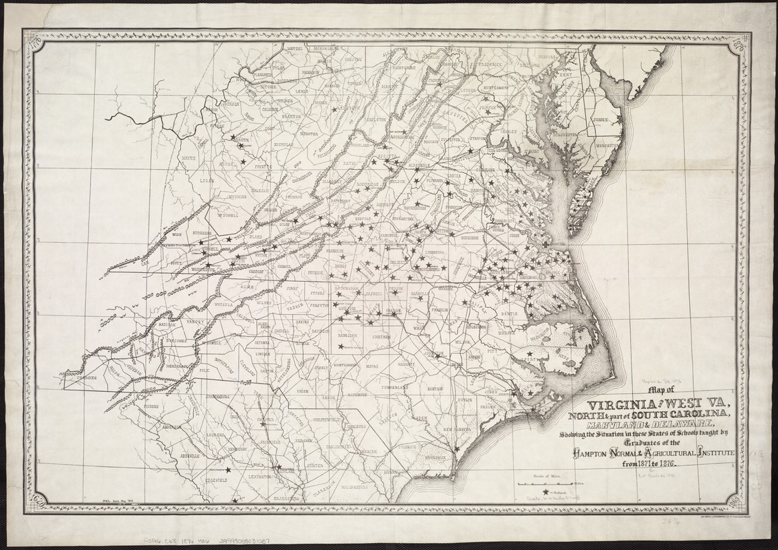
Map of Virginia and West Va., North and part of South Carolina, Maryland and Delaware, showing the situation in these states of schools taught by graduates of the Hampton Normal & Agricultural Institute from 1871 to 1876
Item Information
- Title:
- Map of Virginia and West Va., North and part of South Carolina, Maryland and Delaware, showing the situation in these states of schools taught by graduates of the Hampton Normal & Agricultural Institute from 1871 to 1876
- Creator:
- Hampton Normal and Agricultural Institute (Va.)
- Date:
-
[1876?]
- Format:
-
Maps/Atlases
- Location:
-
Boston Public Library
Norman B. Leventhal Map Center - Collection (local):
-
Norman B. Leventhal Map Center Collection
- Subjects:
-
Hampton Normal and Agricultural Institute (Va.)--Alumni and alumnae--History--Maps
African American teachers--Middle Atlantic States--History--Maps
African Americans--Education--Southern States--History--Maps
Southern States--Maps
Middle Atlantic States--Maps
- Places:
-
Middle Atlantic (area)
Southern United States (area)
- Extent:
- 1 map ; 49 x 72 cm.
- Terms of Use:
-
No known copyright restrictions.
No known restrictions on use.
- Publisher:
-
New York :
Am. Photo-Lithographic Co.
- Scale:
-
Scale 1:1,344,576.
- Language:
-
English
- Notes:
-
Relief shown pictorially.
"M.A.L. fecit May 1876."
- Identifier:
-
06_01_007412
- Call #:
-
G3866.E68 1876 .H36
- Barcode:
-
39999059031037


