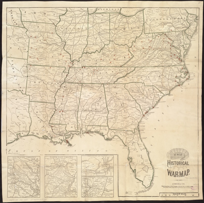
The historical war map
Item Information
- Title:
- The historical war map
- Title (alt.):
-
Rebellion record
- Creator:
- Asher & Co
- Name on Item:
-
Asher & Co.
- Date:
-
[1862?]
- Format:
-
Maps/Atlases
- Location:
-
Boston Public Library
Norman B. Leventhal Map Center - Collection (local):
-
Norman B. Leventhal Map Center Collection
- Subjects:
-
United States--History--Civil War, 1861-1865--Maps
United States--History--Civil War, 1861-1865--Chronology
- Places:
-
- Extent:
- 1 map : col. ; 62 x 62 cm + 1 pamphlet (72 p.)
- Terms of Use:
-
No known copyright restrictions.
No known restrictions on use.
- Publisher:
-
[Indianapolis?] :
Asher & Co.
- Scale:
-
Scale [ca. 1:3,200,000].
- Language:
-
English
- Notes:
-
E. R. Jewett & Co., Engravers, Buffalo, N.Y.
Insets: South-east Virginia -- North-east Virginia -- Charleston and vicinity -- Vicksburg and vicinity.
Rebellion record includes pages (in dif. typeface) added after binding, p. 65-72, which extends chronology to July 15, 1863.
LC Civil War maps (2nd ed.), similar to nos. 22-23.
Issued with: Rebellion record. Syracuse, N.Y. : Union Book Association, [1863?] 72 p.
- Identifier:
-
06_01_007406
- Call #:
-
G3701.S5 1862 .A82
- Barcode:
-
39999059030955


