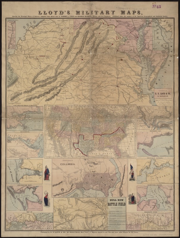
Lloyd's military maps : showing the principal places of interest
Item Information
- Title:
- Lloyd's military maps : showing the principal places of interest
- Creator:
- H.H. Lloyd & Co
- Name on Item:
-
compiled from official data by Egbert L. Viele and Charles Haskins.
- Date:
-
1861
- Format:
-
Maps/Atlases
- Location:
-
Boston Public Library
Norman B. Leventhal Map Center - Collection (local):
-
Norman B. Leventhal Map Center Collection
- Subjects:
-
United States--Maps
- Places:
-
- Extent:
- 13 maps on 1 sheet : hand col. ; 35 x 68 cm. or smaller, on sheet 96 x 72 cm.
- Terms of Use:
-
No known copyright restrictions.
No known restrictions on use.
- Publisher:
-
New York :
H.H. Lloyd ; Published under the auspices of the American Geographical and Statistical Society
- Scale:
-
Scales differ.
- Language:
-
English
- Table of Contents:
-
[Virginia, Maryland, Delaware]
United States
District of Columbia
New Orleans, mouth of Mississippi
Savannah
Mobile Bay
Galveston Bay
Map of Mississippi River [2 maps]
Cairo
Pensacola Bay
Norfolk Harbor
Hampton Roads.
- Notes:
-
Relief shown by hachures.
- Identifier:
-
06_01_007407
- Call #:
-
G3701.S5 1861 .H55
- Barcode:
-
39999059030963


