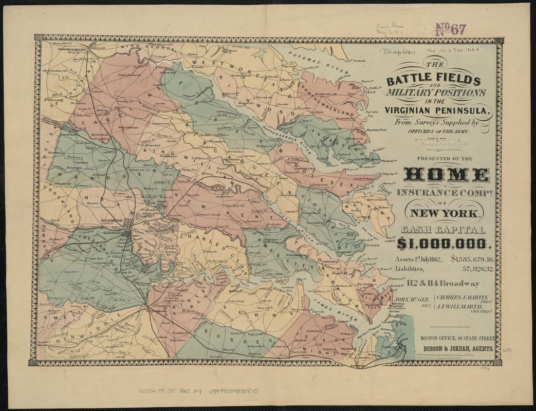
The battle fields and military positions in the Virginian peninsula : from surveys supplied by officers of the army
Item Information
- Title:
- The battle fields and military positions in the Virginian peninsula : from surveys supplied by officers of the army
- Title (alt.):
-
Battlefields and military positions in the Virginian peninsula
- Creator:
- Heald, D. A. (Daniel Addison), 1818-1900
- Date:
-
1862
- Format:
-
Maps/Atlases
- Location:
-
Boston Public Library
Norman B. Leventhal Map Center - Collection (local):
-
Norman B. Leventhal Map Center Collection
- Subjects:
-
Peninsular Campaign, 1862--Maps
Tidewater (Va. : Region)--History--19th century--Maps
- Places:
-
Richmond (county)Tidewater
- Extent:
- 1 map : col., mounted on paper ; 33 x 47 cm.
- Terms of Use:
-
No known copyright restrictions.
No known restrictions on use.
- Publisher:
-
New York :
Home Insurance Co.
- Scale:
-
Scale [ca. 1:375,000].
- Language:
-
English
- Notes:
-
A few battle sites are marked by crossed swords. Shows railroads, towns, county names and boundaries, and drainage--LC Civil War maps / Stephenson.
"Presented by the Home Insurance Compy. of New York."
"Entered according to Act of Congress in the year 1862 by D.A. Heald in the Clerk's Office of the District Court of the Southern District of New York."
- Identifier:
-
06_01_007383
- Call #:
-
G3882.T5S5 1862 .H4
- Barcode:
-
39999059030815


