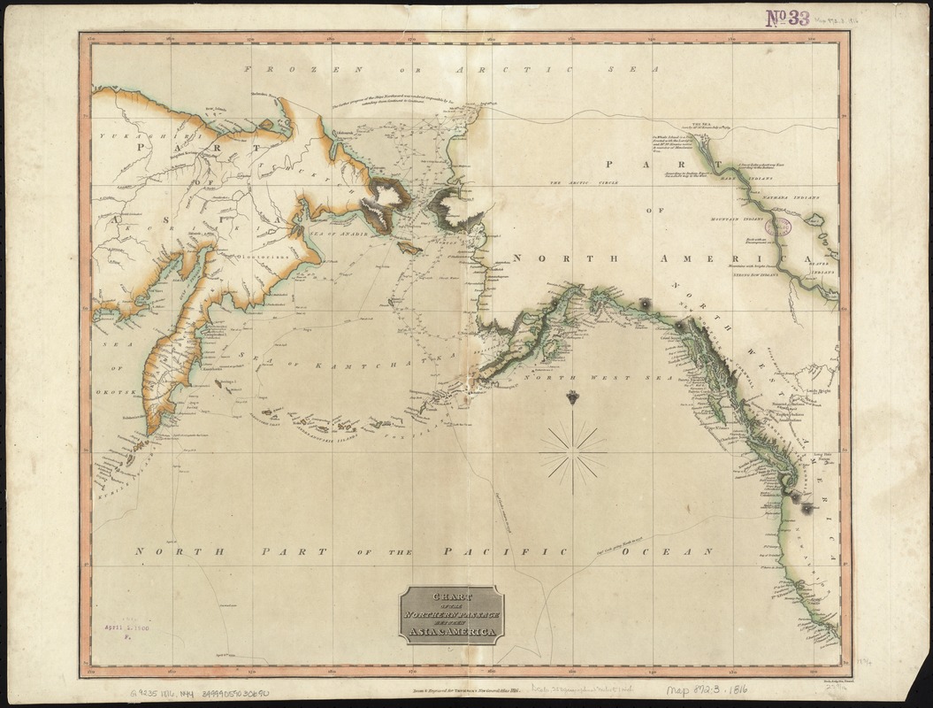
Chart of the Northern Passage between Asia & America
Item Information
- Title:
- Chart of the Northern Passage between Asia & America
- Creator:
- Neele, Samuel John, 1758-1824
- Publisher:
- Thomson, John, 19th cent
- Name on Item:
-
Neele sculp., 352 Strand ; drawn & engraved for Thomson's New general atlas, 1816.
- Date:
-
[1817]
- Format:
-
Maps/Atlases
- Location:
-
Boston Public Library
Norman B. Leventhal Map Center - Collection (local):
-
Norman B. Leventhal Map Center Collection
- Subjects:
-
North Pacific Ocean--Maps
Bering Sea--Maps
Bering Strait--Maps
1816
- Places:
-
Bering Sea
Bering Strait
North Pacific
- Extent:
- 1 map : hand col. ; 48 x 57 cm.
- Terms of Use:
-
No known copyright restrictions.
No known restrictions on use.
- Publisher:
-
Edinburgh :
Printed by George Ramsay for John Thomson and Co.
- Scale:
-
Scale [1:13,500,000].
- Language:
-
English
- Notes:
-
Relief shown by hachures; depths by soundings.
Hand colored in outline.
Shows coastal landmarks and routes of exploration, with descriptive notes.
Coasts of Asia and America around the Bering Sea, including the Aleutian Islands.
Cataloging, conservation, and digitization made possible in part by The National Endowment for the Humanities: Exploring the human endeavor.
- Notes (date):
-
This date is inferred.
- Identifier:
-
06_01_007370
- Call #:
-
G9235 1816 .N44
- Barcode:
-
39999059030690