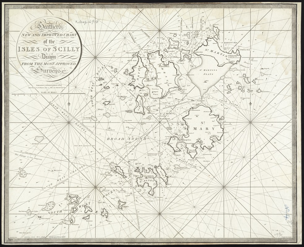
Heather's New and Improved Chart of the Isles of Scilly
Item Information
- Title:
- Heather's New and Improved Chart of the Isles of Scilly
- Creator:
- Heather, William, 1764-1812
- Name on Item:
-
drawn from the Most Approved Surveys ; W. Heather fecit. ; J. Stephenson sculpsit.
- Date:
-
1803
- Format:
-
Maps/Atlases
- Location:
-
Boston Public Library
Norman B. Leventhal Map Center - Collection (local):
-
Norman B. Leventhal Map Center Collection
- Subjects:
-
Isles of Scilly (England)--Maps
- Places:
-
EnglandCornwall (county)Scilly, Isles of (area)
- Extent:
- 1 map ; 62 x 76 cm.
- Terms of Use:
-
No known copyright restrictions.
No known restrictions on use.
- Publisher:
-
London :
William Heather
- Scale:
-
Scale [ca. 1:24,300]. Scale of Miles [3=196mm].
- Language:
-
English
- Notes:
-
Relief shown pictorially and by hachures. Depths shown by soundings.
In: A collection of charts by William Heather.
Cataloging, conservation, and digitization made possible in part by The National Endowment for the Humanities: Exploring the human endeavor.
- Identifier:
-
06_01_007275
- Call #:
-
G5752.S33 1803 .H43
- Barcode:
-
39999059030559


