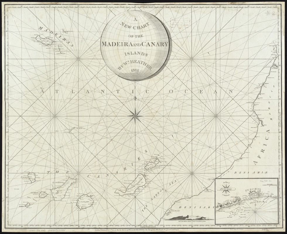
A New Chart of the Madeira and Canary Islands
Item Information
- Title:
- A New Chart of the Madeira and Canary Islands
- Creator:
- Heather, William, 1764-1812
- Name on Item:
-
By W[illia]m Heather ; Stephenson sculp[si]t. ; Drawn by J. Norie.
- Date:
-
1801
- Format:
-
Maps/Atlases
- Location:
-
Boston Public Library
Norman B. Leventhal Map Center - Collection (local):
-
Norman B. Leventhal Map Center Collection
- Subjects:
-
Nautical charts--Madeira Islands
Nautical charts--Canary Islands
Madeira Islands--Maps
Canary Islands--Maps
- Places:
-
SpainCanary Islands (island)
PortugalMadeira (region)
- Extent:
- 1 chart ; 65 x 77 cm.
- Terms of Use:
-
No known copyright restrictions.
No known restrictions on use.
- Publisher:
-
London :
William Heather
- Scale:
-
Scale [ca. 1:1,200,000].
- Language:
-
English
- Table of Contents:
-
Inset: The Bay of Funchal in Madeira.
- Notes:
-
Depths shown by soundings.
Cataloging, conservation, and digitization made possible in part by The National Endowment for the Humanities: Exploring the human endeavor.
- Identifier:
-
06_01_007273
- Call #:
-
G9150 1801 .H43
- Barcode:
-
39999059030534


