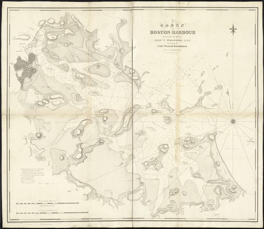
Chart of Boston Harbour : surveyed in 1817
Item Information
- Title:
- Chart of Boston Harbour : surveyed in 1817
- Creator:
- Wadsworth, Alexander S. (Alexander Scammel), 1790-1851
- Name on Item:
-
by Alexr. S. Wadsworth ; by order of Come. William Bainbridge, to whom it is most respectfully inscribed.
- Date:
-
1819
- Format:
-
Maps/Atlases
- Location:
-
Boston Public Library
Norman B. Leventhal Map Center - Collection (local):
-
Norman B. Leventhal Map Center Collection
- Subjects:
-
Nautical charts--Massachusetts--Boston Harbor
Boston Harbor (Mass.)--Maps
- Places:
-
Boston Harbor
- Extent:
- 1 map ; 88 x 103 cm.
- Terms of Use:
-
No known copyright restrictions.
No known restrictions on use.
- Publisher:
-
Philadelphia :
John Melish
- Scale:
-
Scale [1:18,000].
- Language:
-
English
- Notes:
-
Relief shown by hachures. Depths shown by soundings and shading.
"Engraved under the direction of John Melish."
"Allen & Gaw, sc."
Cataloging, conservation, and digitization made possible in part by The National Endowment for the Humanities: Exploring the human endeavor.
- Identifier:
-
06_01_007250
- Call #:
-
G3762.B65 1817 .W3
- Barcode:
-
39999059030351


