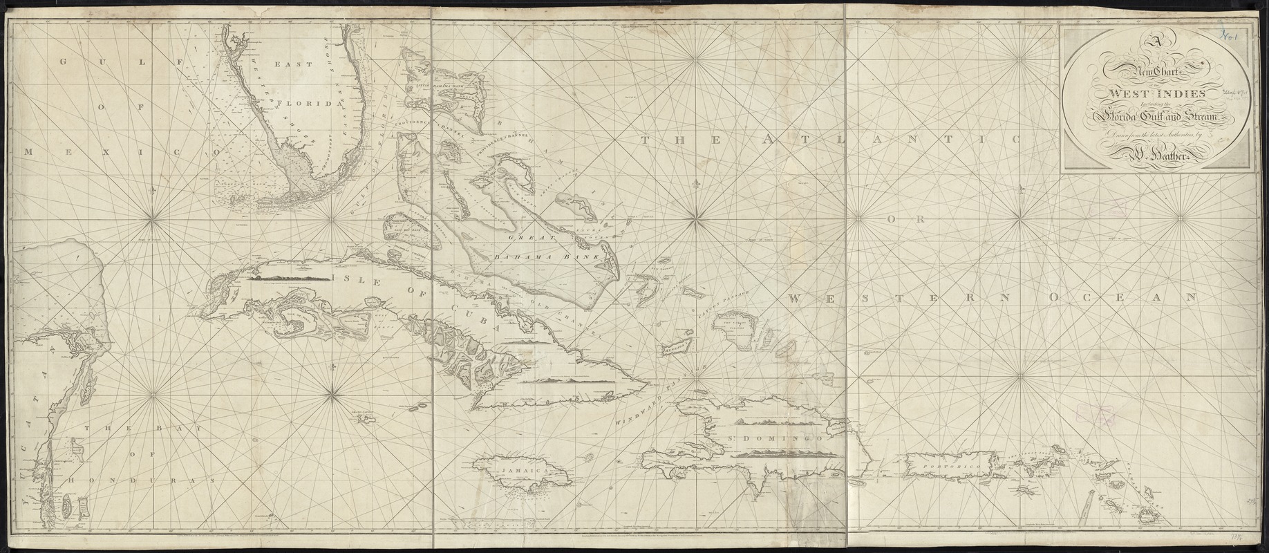
A new chart of the West Indies including the Florida Gulf and Stream
This map is also available in American Revolutionary Geographies Online (ARGO), a collections portal especially built for material relating to the American Revolutionary War Era. Visit ARGO to learn more about this item and explore the historical geography of North America in the late eighteenth century.
Item Information
- Title:
- A new chart of the West Indies including the Florida Gulf and Stream
- Creator:
- Heather, William, 1764-1812
- Name on Item:
-
drawn from the latest authorities by W. Heather.
- Date:
-
1797
- Format:
-
Maps/Atlases
- Location:
-
Boston Public Library
Norman B. Leventhal Map Center - Collection (local):
-
Norman B. Leventhal Map Center Collection
- Subjects:
-
West Indies--Maps--Early works to 1800
Gulf Stream (Fla.)--Maps--Early works to 1800
- Places:
-
West Indies
Atlantic Ocean
- Extent:
- 1 chart ; 77 x 185 cm.
- Terms of Use:
-
No known copyright restrictions.
No known restrictions on use.
- Publisher:
-
London :
by W. Heather, at the Navigation Warehouse, no. 157, Leadenhall Street
- Scale:
-
Scale not given.
- Language:
-
English
- Notes:
-
Depths shown by soundings.
Includes five views of harbor entrances.
Cataloging, conservation, and digitization made possible in part by The National Endowment for the Humanities: Exploring the human endeavor.
- Identifier:
-
06_01_007249
- Call #:
-
G4900 1797 .H43x
- Barcode:
-
39999059030344
![[Alleen de Caribische Eilanden, vervat in 't groot]](https://bpldcassets.blob.core.windows.net/derivatives/images/commonwealth:st74cw59p/image_thumbnail_300.jpg)


