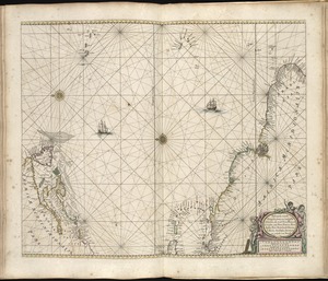
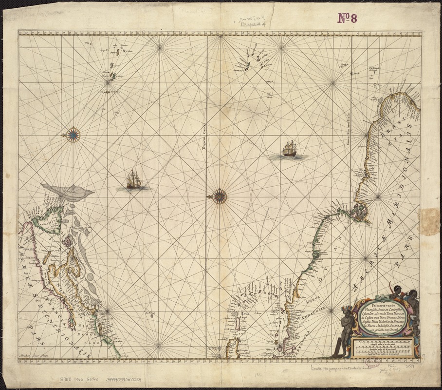
Pascaerte vande Vlaemsche, Soute, en Caribesche Eylanden, als mede Terra Nova, en de custen van Nova Francia, Nova Anglia, Nieu Nederlandt, Venezuela, Nueva Andalusia, Guiana en een gedeelte van Brazil
Item Information
- Title:
- Pascaerte vande Vlaemsche, Soute, en Caribesche Eylanden, als mede Terra Nova, en de custen van Nova Francia, Nova Anglia, Nieu Nederlandt, Venezuela, Nueva Andalusia, Guiana en een gedeelte van Brazil
- Creator:
- Goos, Pieter, ca. 1616-1675
- Name on Item:
-
Abraham Deur fecit.
- Date:
-
[1666]
- Format:
-
Maps/Atlases
- Location:
-
Boston Public Library
Norman B. Leventhal Map Center - Collection (local):
-
Norman B. Leventhal Map Center Collection
- Subjects:
-
Nautical charts--Atlantic Coast (North America)--Early works to 1800
Nautical charts--Atlantic Coast (South America)--Early works to 1800
Nautical charts--North Atlantic Ocean--Early works to 1800
Atlantic Coast (North America)--Maps--Early works to 1800
Atlantic Coast (South America)--Maps--Early works to 1800
North Atlantic Ocean--Maps--Early works to 1800
- Places:
-
North America (area)
South America
Atlantic Ocean
South America
- Extent:
- 1 map : hand col. ; 44 x 55 cm.
- Terms of Use:
-
No known copyright restrictions.
No known restrictions on use.
- Publisher:
-
Amsterdam :
Pieter Goos
- Scale:
-
Scale [ca. 1:13,000,000].
- Language:
-
Dutch
- Notes:
-
Oriented with north to the left.
Includes decorative cartouche and ill.
Appears in the author's Zee Atlas. Amsterdam: Pieter Goos, 1666.
- Notes (date):
-
This date is inferred.
- Identifier:
-
06_01_007226
- Call #:
-
G9110 1666 .G66x
- Barcode:
-
39999059030229